Minds On
Task 1: Let’s get thinking!
Use the checklist below to ask yourself the following questions.
Record your answers in your notebook or a method of your choice. If you would like, you can use speech-to-text or audio recording tools.
Task 2: Geography?
Geography is the study of places and the relationship between people and their environments. Geographers explore both physical properties of the Earth and the human societies spread across it. So why study geography?

Create a mind map that explores a variety of reasons you believe it’s important to study geography. Complete the Geography Mind Map activity in your notebook or use the following fillable and printable document. If you would like, you can use speech-to-text or audio recording tools to record your thoughts.
Press the ‘Activity’ button to access Geography Mind Map.
Action
Task 1: Physical vs. human geography
Physical geography addresses the natural environment. This includes mapping, studying landforms, ecosystems, climates, and weather patterns.
Physical geography
Explore the following images that depict physical geography.
As you consider each image, ask yourself: what do you notice? What do you wonder?
Record your ideas in a notebook or another method of your choice.
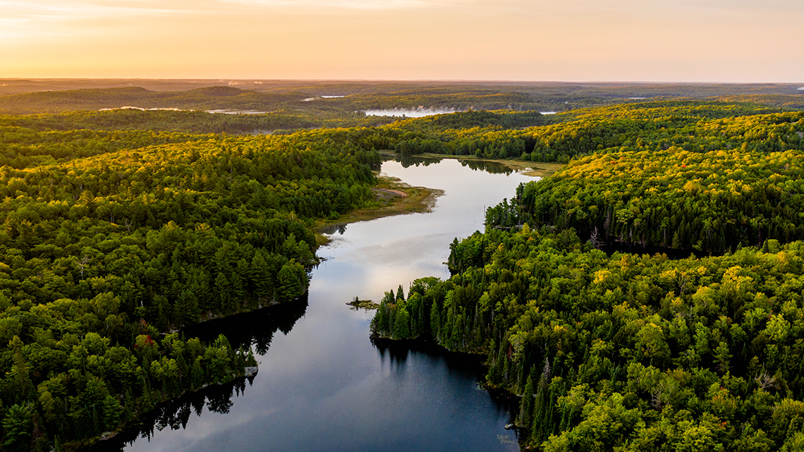
Physical geography is the study of physical features of the Earth.

Physical geography includes examining the climate.
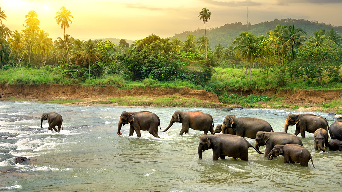
Physical geography also explores the study of species and ecosystems.
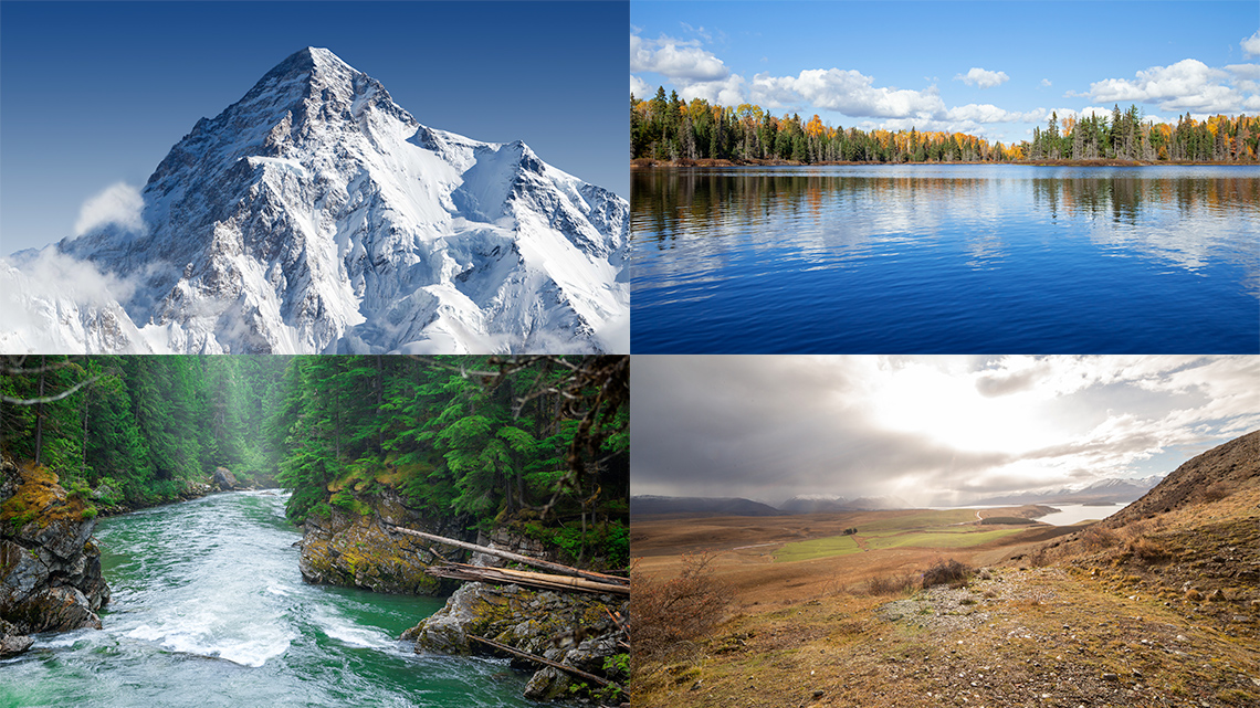
Mountains, lakes, rivers, and soil are all parts of physical geography.

This image is titled “LANDFORMS” and explores a body of water titled “OCEAN” surrounded by land. On the land there are several landforms. On the top left there is a large area of sand. On the sand is a palm tree called “oasis,” canyons, caves, plateau, dune, desert, and mesa. Below the sand is a small river that flows off the edge of an overhang into a lake, labelled waterfall and cliff. Underneath the river is a few trees all close together titled jungle and a canal.
At the bottom left there is a grey land area with a volcano with lava flowing out of it and a geyser which is water shooting out of the ground. On the top right there are several large mountains and snow called a glacier. Other words describe the area: mountain, hill, valley, fjord, sea, cape. Below the mountains is a green area with some small trees and small rivers. There are several words labelling this area: prairie, river, lagoon, delta, tundra, stream, and swamp. There are several trees labelled forest directly below the prairie. On the bottom right is a marsh, pond, and cove. At the bottom are three animals that look like cows and this area is labelled plain. Through the middle of the image is a large body of water with several areas labelled as: iceberg, sea, archipelago, delta, strait, island, isthmus, peninsula.
Physical geography explores a wide range of physical features such as oceans and land masses.
Human geography
Human geography focuses on geographic issues related to human activity, which includes the population distribution of humans on Earth, economic systems, and how humans impact the Earth.

Explore the following images that depict human geography.
What do you notice? What do you wonder?
Record your ideas in a notebook or a method of your choice.
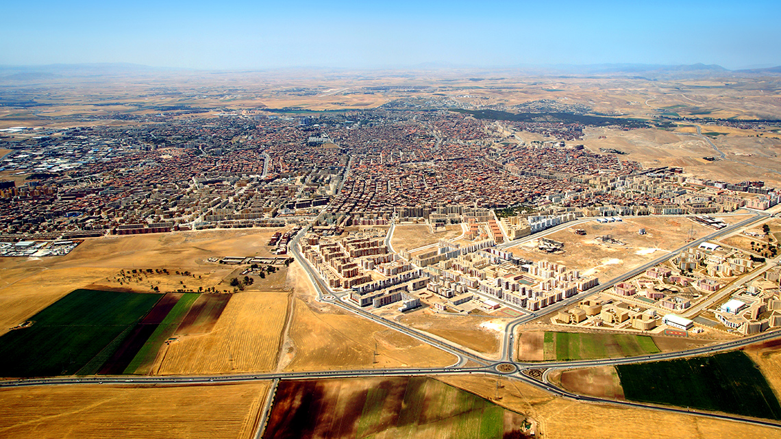
Human geography includes the study of a wide diversity of cultures.

Population characteristics and density are often studied in human geography.
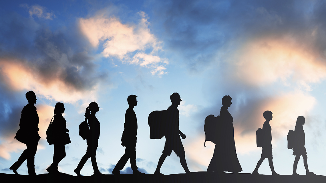
Human geography includes the study of migration, which is defined as the movement of people from one area to another.
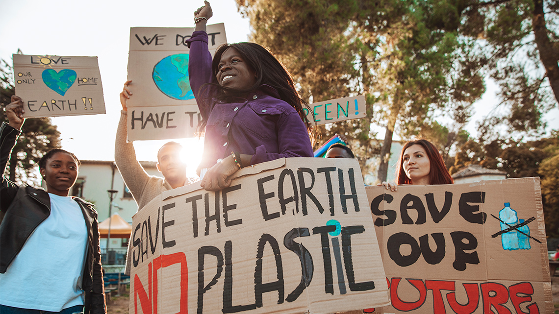
Development of culture, economy, and politics are all subjects explored in human geography.
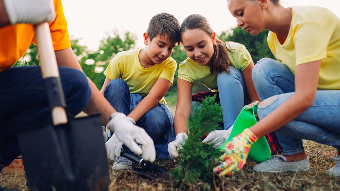
Human geography is defined as a study of how humans interact and impact the Earth.
Human or physical geography?
For the following matching activity, match each term by selecting the corresponding definition.
Considering the definitions of human geography or physical geography, explore each of the following questions and decide if it is human geography or physical geography.
Select the correct answer, then press “Check Answer” to see how you did.
Task 2: Mapping
World map assignment

Becoming familiar with the world map is a skill used in both physical geography and human geography.
In the following activity, you will research images of a world map on your own. You can use online research by looking for geography encyclopedia websites, or you can use resources from a library.
As you research the world map, label and outline the oceans, continents, and significant elements of the world.
Use the following three checklists to make sure you have included all of the necessary labels. If possible, outline the oceans, continents, and lines of latitude in three different patterns or colours to show their positions.
Complete the following Labelling the World Map activity in your notebook or use the following fillable and printable document. You can also use another method of your choice. Use the following checklists to ensure you are not missing anything.
Press the ‘Activity’ button to access Labelling the World Map.
Oceans
Continents
Lines of latitude
Did you…
Double check multiple sources for accuracy?
Make sure your labels are neat and easy to read?
If possible, use a ruler when labelling.
If possible, outline the oceans, continents, and lines of latitude in different patterns or colours.
Choropleth world map
What is a choropleth map? A choropleth map uses changing colours, patterns, or symbols to indicate the average values in a defined area. The map includes a legend that explains what values are indicated by the different colours, patterns, or symbols.
Explore the following map of global life expectancy and record three things you can interpret from the map.
- What does the following map reveal about human life expectancy across the planet?
- What patterns or trends do you see about life expectancy?
- Why do you think there are different patterns or trends in different places?
Record your ideas in a notebook or a method of your choice.

The legend at the bottom includes six colours on the map and the associated life expectancy. Red equals less than 50 years for life expectancy; light red is over 50 years, orange is over 60 years, yellow is over 70 years, light green is over 75 years, and dark green is over 80 years old. North America (Canada and the United States), Peru, Argentina, Norway, Sweden, Finland, Germany, France, Spain, the U.K., Ireland, Portugal, Libya, and Australia are all in the light and dark green depicting over 75 years for life expectancy. Brazil, Cambodia, Algeria, Egypt, Turkey, Ukraine, and China are all yellow depicting over 70 years as the life expectancy. Greenland, Russia, Kazakhstan, Mongolia, Iran, India, and Malaysia all are orange which depicts a life expectancy of over 60 years. Lastly, besides the above-mentioned countries, remaining places including Africa, along with Afghan, and Cambodia are all different shades of red, depicting 50-60 years or less than 50 years for life expectancy.
Task 3: Investigating Pompeii
Connecting physical features and human settlement
Pompeii was a city located in Southern Italy, around the Bay of Naples. In Pompeii, it is humid and warm, with refreshing breezes. The coastal location provided opportunities for farming with rich soil. The natural resources in the surrounding area boosted the local economy significantly. It’s close to the ocean, which provided opportunity for trade and economic development. Essentially, it was an ideal location for human settlement.
However, Pompeii is also located beneath an active volcano and is located on active plate tectonics..
Press the ‘Tectonics’ button to access its definition.

Activity of tectonic plates have shaped the geography of Pompeii resulting in hilly inlands and rocky beaches. It has also created magma flows that boil up and build pressure, which keeps the volcano active. This volcano has erupted more than fifty times, most famously in 79 CE, when the eruption buried the ancient city under a thick carpet of volcanic ash.
Explore images of Pompeii in the following carousel.
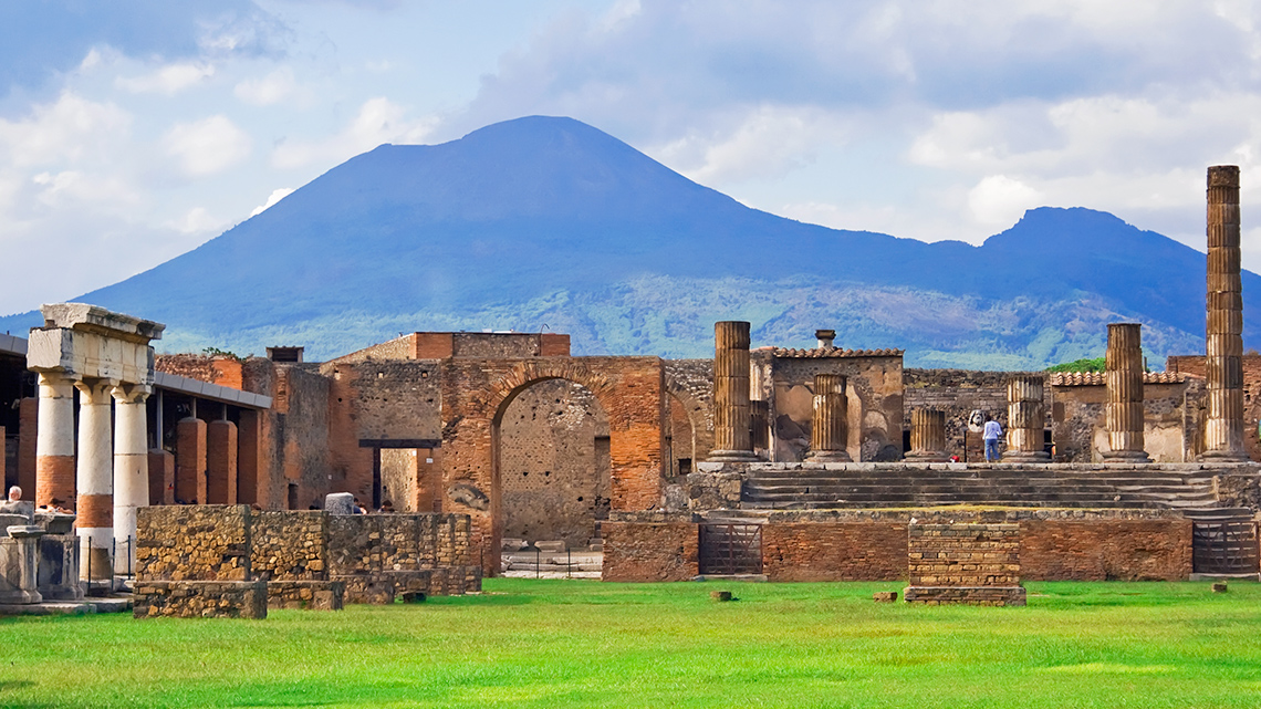
Volcano Vesuvius and the ancient walls of Pompeii
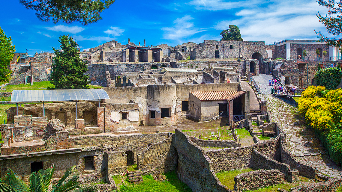
A panoramic View of the Ancient City of Pompeii
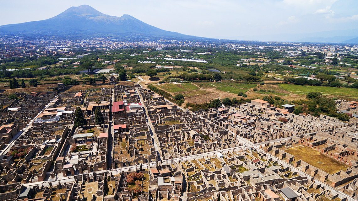
An aerial view of the ruins of Pompeii, Italy
Use the following chart, brainstorm a list of reasons you believe people would stay in Pompeii and the reasons people might want to leave. Be sure to think critically about what you have learned to help you complete the chart.
Complete the following Staying or Leaving Pompeii activity in your notebook or using the following fillable and printable document. You can also use another method of your choice.
Press the ‘Hint’ button to think about the positives and negatives you learned about Pompeii.
| Reasons People Stay in Pompeii | Reasons People Leave Pompeii |
|---|---|
Press the ‘Activity’ button to access Staying or Leaving Pompeii.
Press the ‘Answer’ button to explore possible answers.
Brainstorm
What do you think?
- How have the physical features in the environment of Pompeii impacted human settlement?
- Would you choose to live in the city of Pompeii? Why or why not?
Record your responses in a notebook or a method of your choice.
Consolidation
Making connections
- What is the difference between physical and human geography? Think of specific examples.
- How does the physical environment influence our choice to live somewhere or impact settlement?
- If you could live anywhere in the world, where would it be? Why?
Record your responses in a notebook or a method of your choice.

Reflection
As you read the following descriptions, select the one that best describes your current understanding of the learning in this activity. Press the corresponding button once you have made your choice.
I feel...
Now, expand on your ideas by recording your thoughts using a voice recorder, speech-to-text, or writing tool.
When you review your notes on this learning activity later, reflect on whether you would select a different description based on your further review of the material in this learning activity.
Press ‘Discover More’ to extend your skills.
Discover More1. Use an online resource, map, or app to explore different parts of the world using an earth view.
As you are exploring, create jot notes about different places in the world and the different human and physical geography you notice.
For example, record if there are bodies of water nearby, mountains, lots of houses, and etc.
2. Then, reflect on the following question:
Is there somewhere new you would like to live? Why?
Record your notes and responses in a notebook or another method of your choice.