Minds On
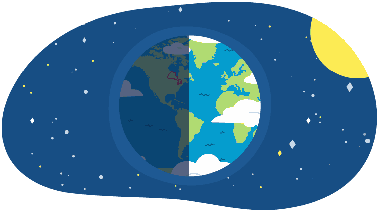
What’s the weather like?
Brainstorm
Brainstorm
Let’s brainstorm about the following questions:
- Why isn’t every place on earth the same temperature?
- Why is the earth so warm during the day and cooler at night?
- How does the ocean affect temperatures?
Record your ideas in a notebook or another method of your choice.
Investigate
Predict
In Ontario, some people live near large bodies of water, such as the Great Lakes.
Do you think that people who live closer to the Great Lakes experience different weather or climate, than those who are farther away? If so, why?
Record your predictions in a notebook or another method of your choice.
Action
Climate patterns
In this learning activity, we are going to be exploring climate patterns and the impact of the earth’s water systems on atmosphere and climate.
Let’s start in Ontario by investigating the areas surrounding Lake Erie.
Investigate
Investigate
Let’s investigate climate patterns in four cities near Lake Erie.
Then, predict how the data relates to each other.
Press ‘Hint’ to access a few helpful tips.
- “Average monthly temperature range” is the average difference between the maximum and minimum temperatures for the month.
- “Annual precipitation” is the total amount of precipitation per year. This can include rain, snow, sleet, or hail.
Complete the Cities and Climate Patterns Activity in your notebook or using the following fillable and printable document. If you would like, you can use speech-to-text or audio recording tools to record your thoughts.
|
City |
Distance from lake (km) |
Average monthly temperature range ℃ |
|---|---|---|
|
A |
0.0 |
7.6 |
|
B |
1.6 |
8.8 |
|
C |
48.3 |
10.8 |
|
D |
80.5 |
11.9 |
|
City |
Number of frost-free days per year |
Annual precipitation (cm) |
|---|---|---|
|
A |
205 |
73.6 |
|
B |
194 |
81.4 |
|
C |
162 |
94.0 |
|
D |
154 |
97.5 |
After exploring the data table, let’s predict for the following questions:
- How does the distance from the lake affect temperature, frost-free days, and precipitation?
- How might these pieces of data investigated in this chart be related to each other?
Press the ‘Activity’ button to access Cities and Climate Patterns Activity.
The water cycle
The water cycle is the process where water circulates between the atmosphere, land, and oceans of the earth. It is a process on Earth where water converts between each of the three states of matter (solid, liquid, gas), fueled by the energy from the sun.
Check out the following image to explore certain parts of the water cycle.

This water cycle diagram features the sun in the top left corner and a directional arrow pointing towards the right against a group of clouds labelled “condensation,” followed by a dark grey group of clouds in the top right corner. Underneath the grey clouds is a downward arrow labeled “precipitation” that shows rainfall onto trees and into a river. An arrow points towards the left along the river with the label “collection,” and a final upward-pointing arrow labelled “evaporation” shows air rising up from the water towards the sun in the top left corner.
Explore the following descriptions to learn more about the various aspects of the water cycle.
For each state of the water cycle, select the corresponding description.
Water and climate
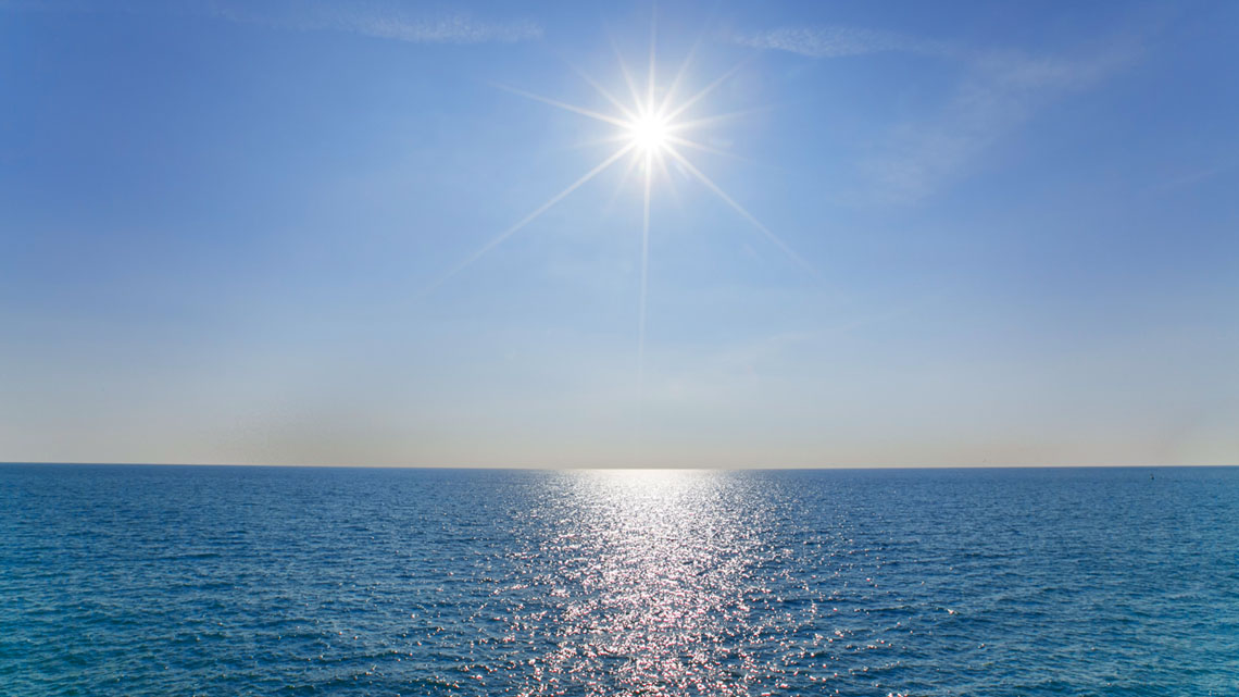
A substance that is able to absorb thermal (heat) energy without becoming significantly warmer is called a heat sink. Water is a prime example of a heat sink because large bodies of water are constantly moving and mixing cool water and warm water heated by the sun. Large bodies of water, like oceans or lakes, absorb a lot of heat from the sun, yet their temperature remains consistent.
Air and water
Air above the land warms up faster than air above the water.
When the air becomes warmer, it becomes less dense. The cool, heavy air sinks, pushing the warm, light air, upwards. This causes air movement called “convection currents” or wind.
You can explore these further in the following diagram of sea breeze and land breeze.
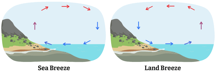
One panel demonstrates the sea breeze. With the cold arrows from the sea moving to the land, and the warm air moves to the ocean or sea. The next panel is for land breeze. With cold air from the land moving towards the sea/ocean, where the warm air moves towards the land.
This is what makes land near water a more moderate climate than land that is farther away from bodies of water.
A moderate climate is a climate that is not too hot or too cold. Each climate feature (such as temperature, daylight, rain, etc.) is “medium” and generally doesn’t go to an extreme at either end.
Coastal areas and climate
Press the following tabs to explore how climate impacts coastal areas and Ontario’s Great Lakes regions.
People who live in coastal areas (surrounding the oceans or lakes) experience more moderate climates because of the effects of the ocean currents.
How does water affect the climate in coastal areas?
One unique property of water is its high heat capacity. This is due to hydrogen bonds that exist between water molecules. Large bodies of water change temperature slower than land masses.
Land masses that are near large bodies of water, like the ocean, change temperature with the ocean, which is slower and with less extreme fluctuation. Why?
Water stores energy. On average, the amount of energy needed to increase the temperature of a body of water is four times greater than the amount of energy needed to increase the temperature of land. Therefore, large bodies of water heat up and cool down more slowly than land masses, so their temperature changes less dramatically with each season.
With seasonal changes, large bodies of water tend to release heat during the winter and soak it up during the summer. This keeps temperatures within a more moderate range. Ocean currents also play a part. They act as a giant conveyor belt that transports heat to other areas that enjoy a warmer climate, rather than a moderate one.
In conclusion, tropical regions have warm land and water most of the year.
The warm ocean waters give rise to tropical storms (i.e., cyclones, hurricanes) as masses of water vapour rise from warm ocean water.
This water saturates the air and begins to condense, which releases large amounts of heat so that the ocean surface of the ocean remains warm and continues the cycle.
So, how do the Great Lakes affect areas in Ontario?
The climate of southern Ontario is influenced by the Great Lakes.
The Great Lakes affect weather and climate by impacting the water basin’s energy and water cycles. Changes in the Great Lakes’ water circulation, water temperatures, and ice coverage can produce changes in weather patterns.
The Great Lakes are large enough to influence weather in their region.
The Great Lakes influence daily weather by:
- moderating temperatures in all seasons, producing cooler summers and warmer winters, similar to coastal locations around the oceans
- increasing cloud coverage and precipitation over and just downwind of the lakes during winter
- decreasing summertime convective clouds and rainfall over the lakes
Cause-and-effect
Scientists are always studying cause-and-effect relationships to learn more about our world.
By exploring how the water cycle creates one of the following weather conditions, you are learning more about a cause-and-effect relationship, which is a particular kind of relationship or connection. This kind of knowledge allows us to make useful predictions.
Explore the following images and descriptions to learn more about different weather types and how they’re formed. Press the flip button to access both sides of the cards. Use the arrow keys to navigate between cards.
Try It
Your turn!
Choose a weather condition that we have explored (rainy, snowy, foggy, or cloudy).
Then, describe how the water cycle plays a role in creating that weather condition.
Consider:
- how the water cycle works
- how parts are interconnected or related
- how your explanation can describe components of the water cycle
Record your ideas in a notebook or another method of your choice.
Consolidation
Review your learning

For each sentence, select the missing word from the drop-down menu.
Pause and Reflect
Pause and reflect
In this learning activity, you’ve investigated the water cycle and how the water cycle and large bodies of water impact the weather and climate.
Reflect on the following questions:
- What is a cause-and-effect relationship?
- Using a cause-and-effect relationship, explain how large bodies of water can change the weather in a specific area?
- How does this relationship therefore affect the climate?
Record your ideas in a notebook or another method of your choice.
Reflection
As you read the following descriptions, select the one that best describes your current understanding of the learning in this activity. Press the corresponding button once you have made your choice.
I feel…
Now, expand on your ideas by recording your thoughts using a voice recorder, speech-to-text, or writing tool.
When you review your notes on this learning activity later, reflect on whether you would select a different description based on your further review of the material in this learning activity.