Minds On
What’s the weather?
Explore the following images and descriptions. What do you notice?
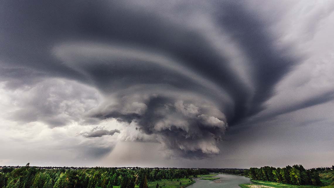
Dark clouds form in a spiral over the Bow River in Calgary, Alberta.
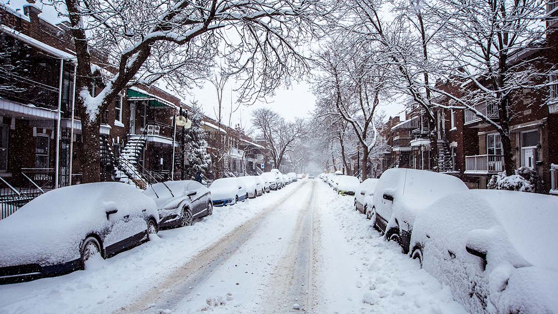
Trees, cars and a street covered in snow after a snowstorm in Montreal, Canada.
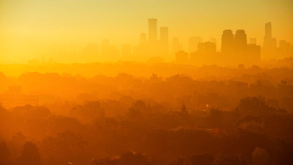
Smog covers the Toronto skyline. The sky is colored with hues of orange and yellow.
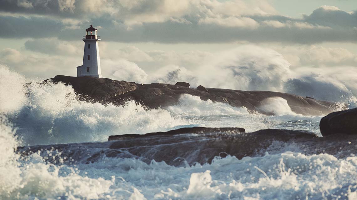
A coastal storm creates crashing waves against Peggy’s Cove Lighthouse in Nova Scotia, Canada.
How might the weather in each of these examples affect structures, homes, people, and animals?
Action
While the content in this learning activity is aligned to the curriculum, some content may be sensitive to individual learners. Consider reaching out to a trusted adult to share your feelings and questions.
Weather
Weather is a specific event or condition that happens over a period of hours or days.
A thunderstorm, a snowstorm, smoggy conditions, and the temperature all describe the weather.
Weather can change from day to day, and from one year to the next.
For instance, Ontario might have a warm winter one year and a much colder winter the next. This kind of change is normal.
However, when normal weather patterns begin to change a lot, it could be a sign of climate change.
Explore the following mind map.
What do you notice is a cause of climate change?
What are some examples of climate change?

Greenhouse gases trap energy in warmer atmospheres. The warmer atmosphere leads to melting snow and ice on the earth, more evaporation, warmer oceans, and changing conditions for plants and animals.
This leads to the earth absorbing more energy, rising sea levels, stronger storms, more precipitation, increase in droughts and wildfires, changes in seasonal patterns, shifting ranges and migration, and habitat loss and extinction for many plants and wildlife.
The earth is getting warmer as people add heat-trapping gases to the atmosphere, mainly by burning fossil fuels. These gases are called greenhouse gases.
As temperatures increase globally, they create many changes around the world. These include:
- melting snow and ice in the northern regions
- loss of habitats (homes) for different animals
- changes in the pattern of seasons around the world
- natural disasters
Let’s explore how climate change can increase the number of natural disasters around the world.
Extreme forces
As climate change occurs, there is an increase in many natural disasters. These can affect people, animals, plant life, habitats, and homes.
There are several different types of extreme forces or natural disasters. Explore the following accordion to learn more about a few.
Press the following tabs to access types of natural disasters.
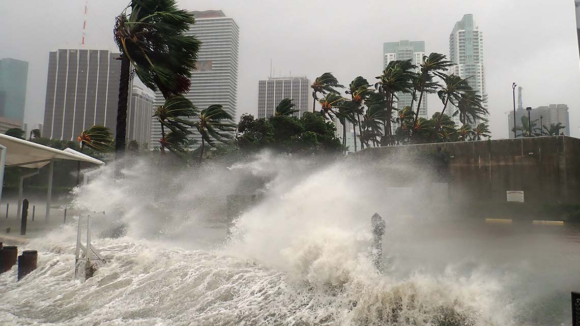
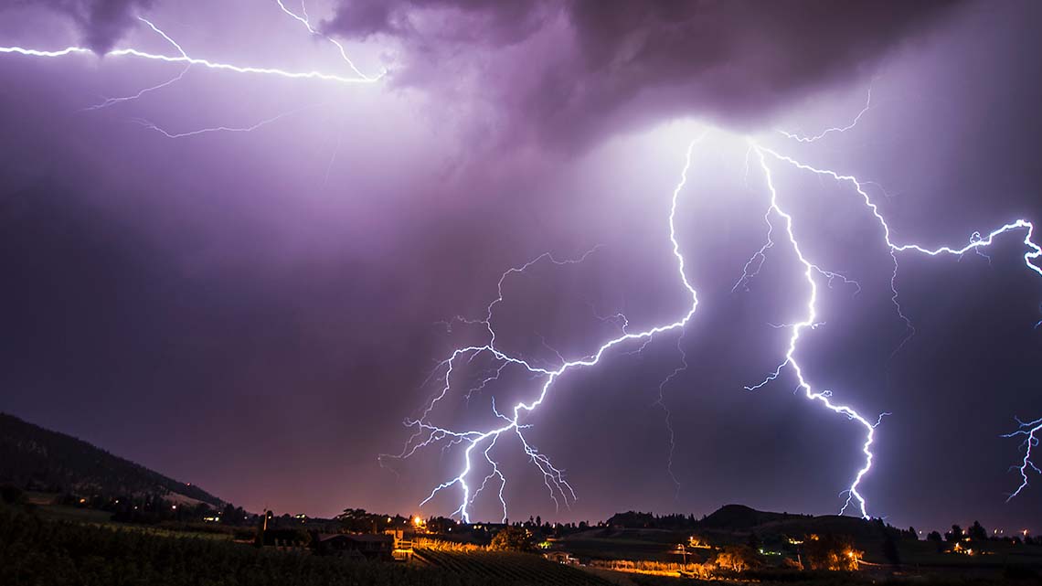
A hurricane is an extremely windy condition or a huge storm, where the wind force is so high that it can be very destructive. It has very strong, spiralling winds. The centre of the hurricane is called the eye and it is the calmest part of the storm.
A hurricane can last over a week. A typical hurricane has sustained winds of 100–150 miles per hour (mph). Winds in some stronger storms may can go over 200 mph.
When hurricanes reach the land they can bring heavy rains, strong winds, and large waves. These can blow away anything that comes in its way including houses, cars and trees.
The earth is made up of many plates. These are called tectonic plates.
When the plates slide past each other or collide against each other, this causes earthquakes. The earth experiences more than a million earthquakes every year!
Earthquakes have the power to cause changes on the earth’s surface. Sometimes an earthquake can be mild, which does not cause much harm, but it can also be very strong and that can cause a lot of destruction.
Earthquakes can collapse buildings, damage power grids, and break pipelines for water and gas. Some earthquakes can be strong enough to trigger landslides or snow avalanches and, in some cases, even volcanic eruptions.
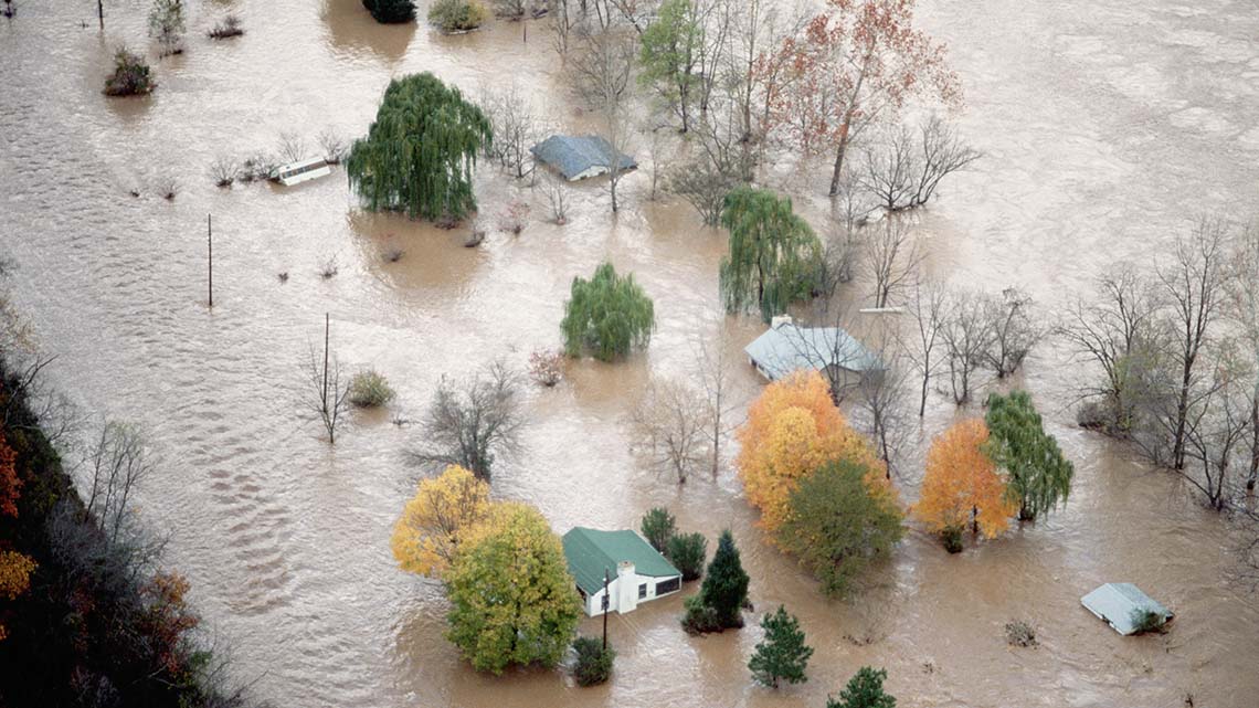
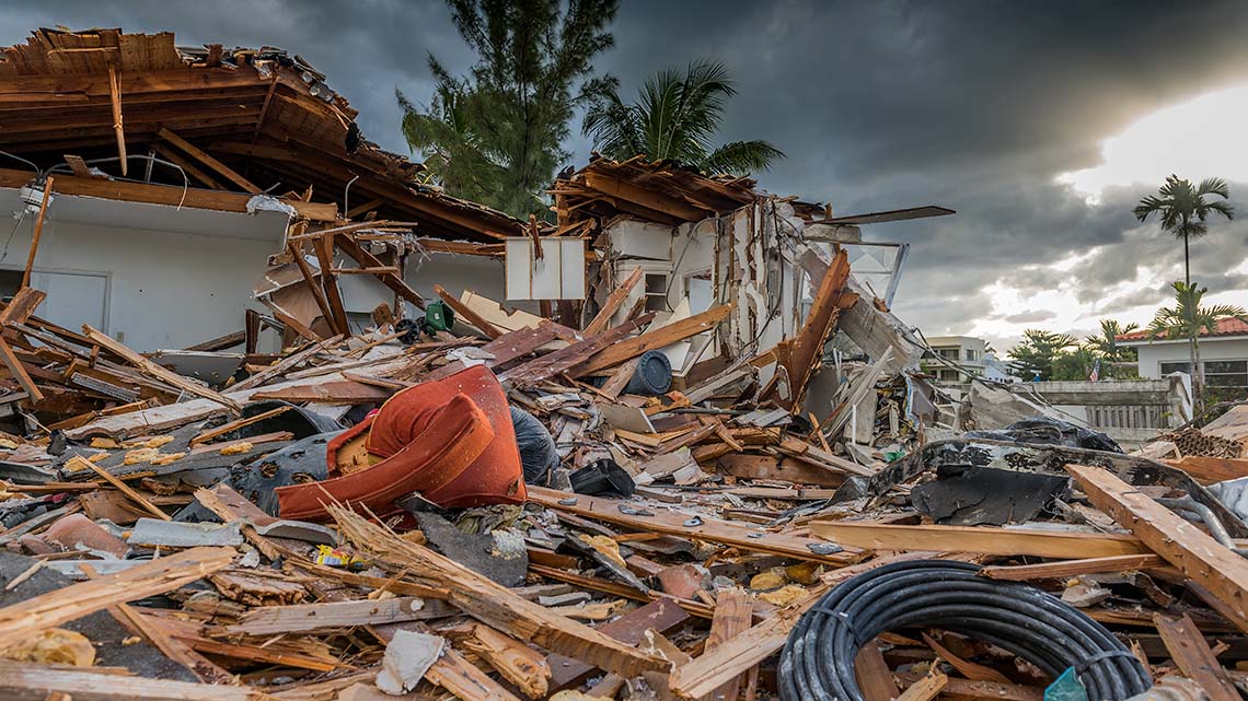
A flood is an overflow of water on land that is typically dry.
Floods can be extremely dangerous and can wipe away an entire city, coastline, or an area, and cause a lot of damage to life and property.
Some floods can occur suddenly and stop soon after– which means the water level goes down again quickly.
However, other floods can take days or even months to stop.
A flood has the power to wipe away farms, trees, and much more. When a strong flood happens in an area where there are a lot of homes, buildings, and structures, the water can carry away whole houses, bridges, cars, furniture, and even humans and animals!
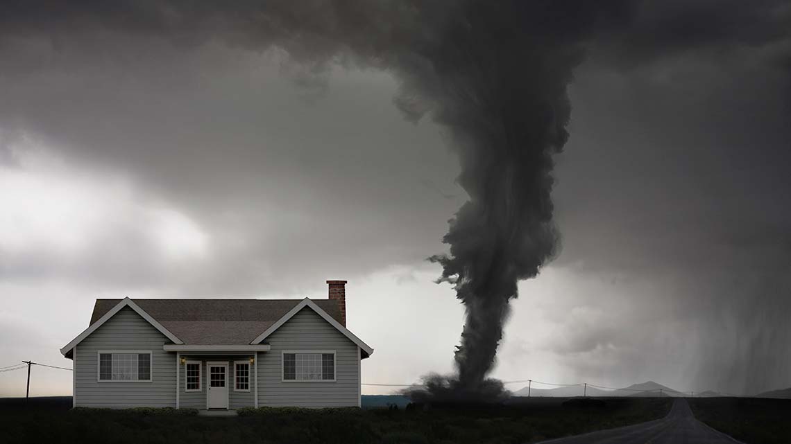
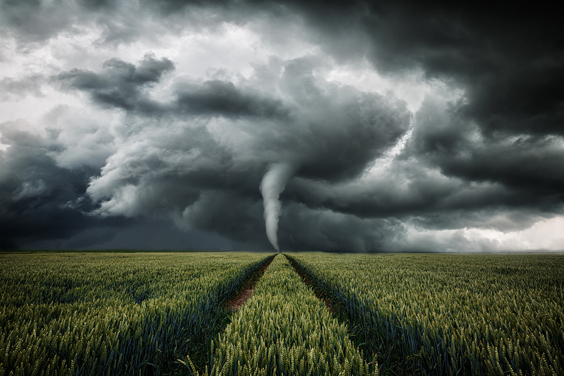
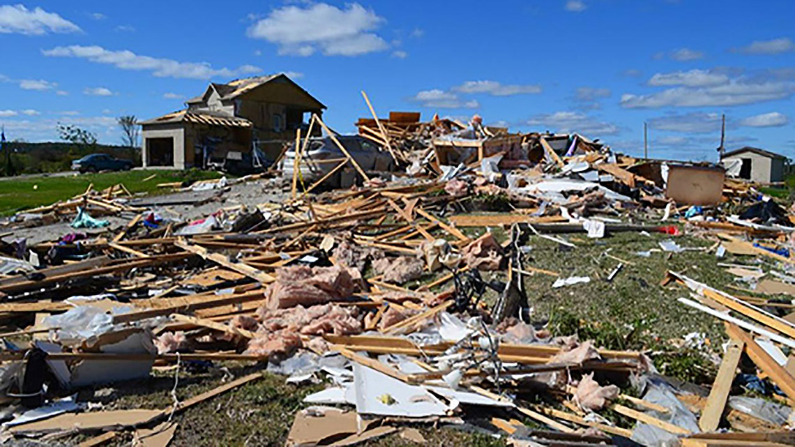
Tornadoes are nature’s most violent storms and are also known as twisters or cyclones.
They can take the form of a funnel shaped cloud and their narrow end touches the ground.
Tornadoes have whirling winds that can travel up to 300 miles per hour. A huge cloud of dirt and dust often circles the tornado.
Tornadoes can cause a lot of destruction in seconds. Because tornadoes develop quite quickly, it is sometimes not possible to give ample advance warning of a tornado.
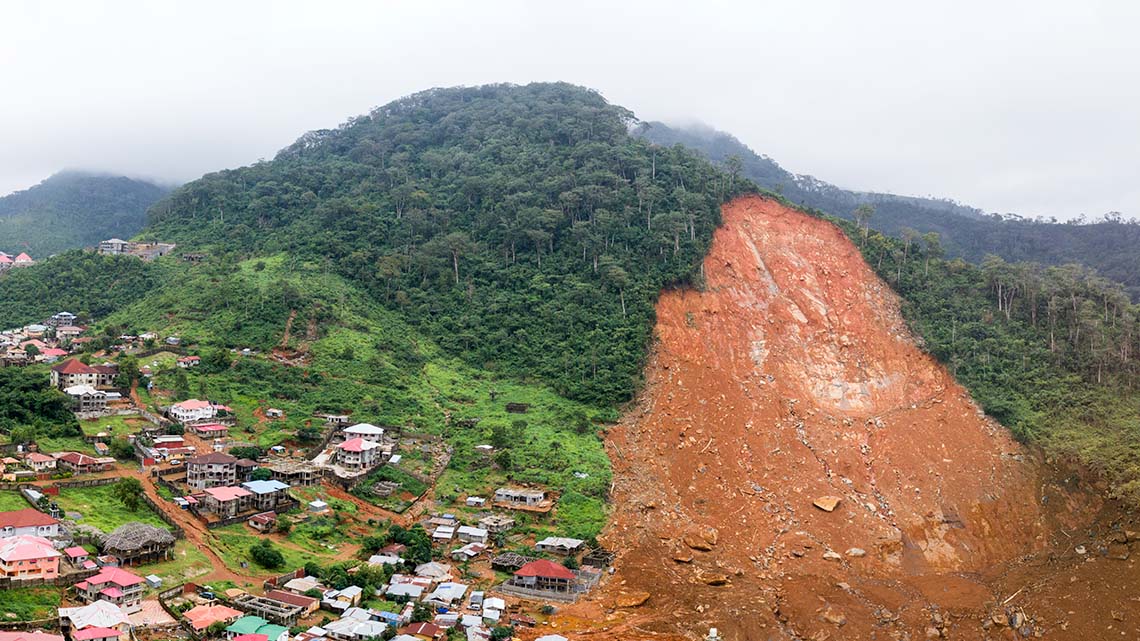
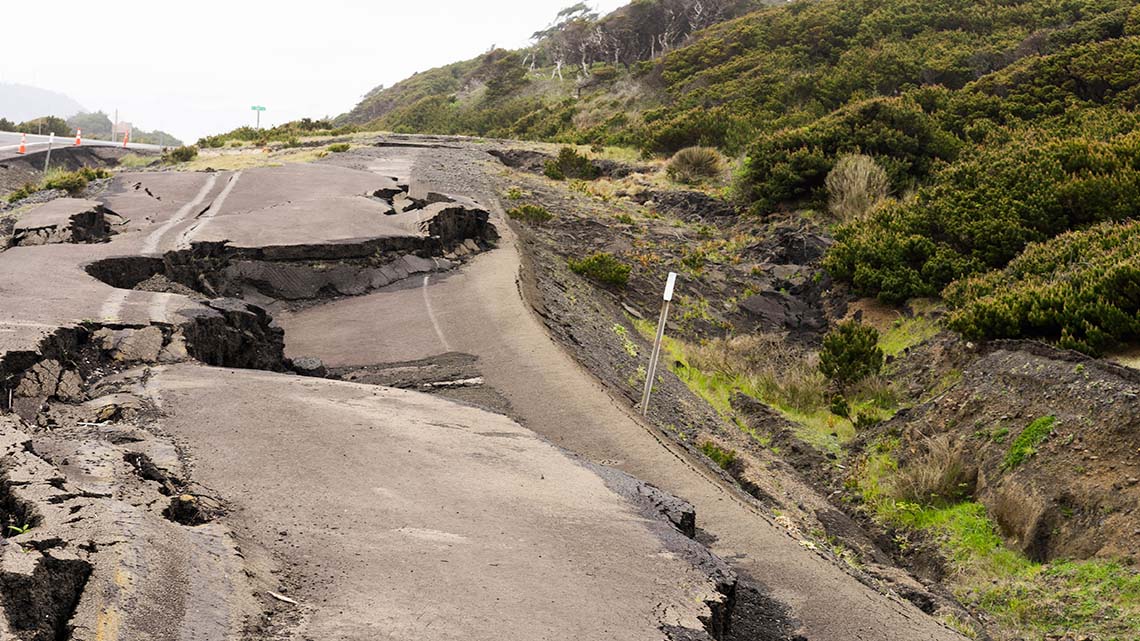
A landslide is the movement of a big rock or a big part of land down a sloped section of a hill or a mountain.
There can be many reasons behind a landslide.
For example,
Heavy rain, earthquakes, and volcanoes can all lead to a landslide.
Cutting down forests and/or removing plant life can also lead to a landslide.
Let’s reflect on the extreme forces of nature. Describe each example provided, the type of damage each can create (i.e., consider structures, habitats, people, and animals), and any questions you may have.
Complete the Natural Disasters Activity in your notebook or using the following fillable and printable document. If you would like, you can use speech-to-text or audio recording tools to record your thoughts.
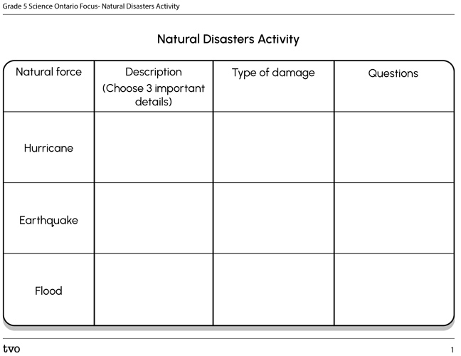
Press the Activity button to access the Natural Disasters Activity.
Activity (Open PDF in a new tab)Ontario connection
This learning activity highlights people, places, or innovations that relate directly to the province of Ontario. Enjoy the exploration!

Tornado detectives
What happens when scientists and engineers study natural disasters? They figure out why they occur, and brainstorm how to find out more. Let’s explore an example of tornado research in Ontario.
Consider what you have learned about tornadoes. What kind of technology do you think someone might use to learn more about tornadoes?
Explore the following excerpt from the TVO article “Meet Ontario’s tornado detectives” to find out!
Press Definitions to access the meanings of some words you will need to know.
Satellite imagery: Satellite images are photographs of the Earth taken by satellites in space.
Aerial photography: A photograph taken of the ground from the air above. Aerial photography can be taken from a plane, or another flying device.
Resolution: Resolution refers to the amount of detail included in the photograph.
Reading Time
Let’s read a story about something
A new project led by researchers at Western University aims to collect data on every tornado in Ontario this year. We talk to Professor Gregory Kopp about his team’s unique New Year’s resolution — and about the risks and rewards of storm-tracking
Enter the Northern Tornadoes Project, a Western University-led team that has been working since 2017 to identify and collect data on tornadoes that would otherwise be missed. Last year, it logged information on 12 previously undetected tornadoes across the country (nine of them in Ontario). Its resolution for 2019? To collect data on every tornado in Canada.
Gregory Kopp, the project leader and an engineering professor at Western, talks to TVO.org about the pioneering initiative, the science behind it, and why it’s important to determine that a tornado has occurred — even if no one was around to see it.
[Question]: Tornadoes form during thunderstorms, so are they more common in the summer?
[Gregory Kopp]: Yes, but you can have them in any month of the year. A few years back [in 2005], there was a tornado in November in Hamilton.
[Question]: So how does your project find tornadoes?
[Gregory Kopp]: We subscribe to a satellite-imagery service that gives us an image resolution of about two metres. We look on the days before a storm, and we look on the days after a storm, and with a resolution of two metres, you can see the scars left on vegetation and other things.
If we see any hint of tornado damage, we hire an aerial-photography company that will fly over those areas and take imagery for us with a resolution of about five centimetres.
With that kind of resolution, we can identify individual damaged trees and the branches, sometimes. We get that data for the whole track of the storm. We use the details of the trees to try to estimate the intensity of the tornado, as well.
We use social media, also, to determine where a tornado has occurred, and that’s typically in populated areas. There are lots of instances where people have seen it and photographed it and put it on social media.
After exploring the article, consider and respond to the following questions. Record your ideas in a notebook or another method of your choice.
What kind of specific technology is Gregory Kopp and his team using to track tornadoes?
Press Answer to access the technology that Gregory Kopp is using.

Gregory Kopp and his team use satellite-imagery, aerial photography, and information from different social media users to track tornadoes.
Why might this type of tracking be important or helpful to the communities?
Press Possible Answer to access how the tracking would be helpful to communities.
It might be helpful to the communities because if the team is able to track a pattern and/or specific areas where tornadoes occur, communities can predict when tornadoes are most likely to happen and come up with a plan to protect each other.
Are there other types of technology that the team might consider using in their research?
Record your thoughts using a method of your choice.
Consolidation
Research opportunity

Time to conduct your own research! Use the scientific research process to find more information about natural disasters.
Check out this video to learn about the steps of the Scientific Research Process.
Consider what you have learned about different extreme forces in nature. Select one from the following list and conduct additional research. You may also refer to the Extreme Forces of Nature activity in the Action and begin with your notes.
- Volcanoes
- Hurricanes
- Tornadoes
- Earthquakes
- Landslides
- Wildfires
- Drought
You may use the following questions to guide you.
Where does this natural disaster happen (i.e., which areas in around the world)?
What are possible causes for this natural disaster?
Are there types of technology that can help us to learn more about this type of natural disaster?
How does this natural disaster affect people, animals, and the environment?
Record your information using a method of your choice.
Reflection
As you read through these descriptions, which sentence best describes how you are feeling about your understanding of this learning activity? Press the button that is beside this sentence.
I feel…
Now, record your ideas using a voice recorder, speech-to-text, or writing tool.