Minds On
Canadian regional diversity
Let’s begin by considering how people are affected by their natural environment, and why people decide to settle in a variety of regions.

Think about the following questions and respond using a method of your choice:
- How does the natural environment affect travel?
- How does the natural environment impact people’s daily lives?
- What do you think draws people to live in certain areas?
Press Hint to explore prompts to guide your thinking.
Throughout this learning activity, you can record your ideas and responses on the computer, orally, or on paper.
Action
Physiographic regions of Canada
Trade, travel, and the types of food that were grown were all influenced by the physical environment in which First Nations and Inuit peoples lived before the 1700s.
Student Tips
Referencing years by the century
In order to understand how the physical environment can affect how communities lived before the 1700s, and continue to live today, let’s explore the physiographic regions of Canada and consider the physical environment across Canada.

This map of Canada is divided into seven physiographic regions. In British Columbia and a portion of Yukon territory and Alberta, is the Western Cordillera. Alberta, Saskatchewan, the southern portion of Manitoba, Yukon Territory, and Nunavut are all part of the Interior Plains. The Canadian Shield covers much of Ontario, Quebec, Labrador, Nunavut, and the Northwest Territories. The Hudson Bay Lowlands cover the southwest portion of land on the coast of Hudson Bay (Ontario, Manitoba, and a small portion of Nunavut). Arctic Lands take up the northern islands of the three territories. The St. Lawrence Lowlands cover the southeastern part of Ontario around the Great Lakes and into the south area of Quebec, along the St. Lawrence River. The Appalachian Region covers much of the East Coast of Canada, including New Brunswick, Nova Scotia, Prince Edward Island, and Newfoundland.
Exploring the regions
Press each of the following regions to access more information about them.

The northwestern region of Canada along the Pacific coast. The region includes mountains, plateaus, and basins in British Columbia, the Yukon, and parts of the Northwest Territories. The climate on the Pacific coast is rainy and produces heavy snow in the mountains. Temperatures on the coast are generally milder than the rest of Canada. The many forests, lakes, rivers, and the Pacific Ocean allow for fishing and agriculture. There are many species of trees in this region. Animals in the region include caribou, squirrels, bears, and deer.

The Interior Plains are flatlands that cover parts of Manitoba, Saskatchewan, Alberta, British Columbia, the Yukon, and Northwest Territories. The climate features hot summers and extremely cold winters. The vegetation includes trees, shrubs, grass, and some plants, including oats, barley, and wheat. There are extensive grasslands, and a great part of the land is used for farming. Animals in the Interior Plains include the wolves, deer, and elk.

The image shows the Arctic landscape on Ellesmere Island. Snow covered peaks and windy conditions characterize this region in the winter.
The polar region of Canada, which includes parts of the Northwest Territories, the Yukon, and Nunavut has a climate that can reach extremely cold temperatures in winter. Summers are short and cool. Vegetation is scarce, as much of the ground is permanently frozen. The region is north of the boreal forest in the tundra. This is above the tree line, so no plants can grow in this region. Animals in the Arctic include seal, polar bears, the artic fox, reindeer, and walrus.

This region of Canada features wetlands on the southern coast of Hudson Bay and James Bay in Ontario, Quebec, and Manitoba. There is an abundance of wildlife, and the region has cold winters and hot summers. There are only a few types of trees and bushes that grow in this area due to the wetness of the land. Animals in the region include Canadian geese, caribou, ducks, and swans.

The Canadian Shield is the region that features exposed Precambrian rocks (layers of rock) that were responsible for forming the North American continent. The region is vast and includes parts of Ontario, Quebec, Manitoba, Saskatchewan, Alberta, Northwest Territories, Nunavut, and Newfoundland and Labrador. Although there are a small variety of trees in this region, because of the rock, there are not many other plants that grow. Many of the animals in the Canadian Shield region are commonly associated with Canada. They include beavers, moose, bears, wolves, and foxes.

Located in southern Ontario and Quebec, the St. Lawrence Lowlands run next to the St. Lawrence River and the Great Lakes. The rich soil provides for excellent farming and large forests. There is a great variety of trees found in this region. The climate is hot and humid in the summer and cold in the winter. Animals in the region include otters, beavers, muskrats, and many different birds.

The Appalachian Region features rolling hills and mountains covered with forests. It includes parts of New Brunswick, Quebec, Prince Edward Island, Nova Scotia, and Newfoundland and Labrador. The climate includes warm and humid summers and cold winters. There are a great number of forests in this region with many species of trees. Animals include the flying squirrel, garter snake, salamanders, bears, beavers, deer, wild boar, and foxes.
Checking your understanding
Let’s check our understanding of these physical regions! Use the information from the accordion to complete one (1) of the following two (2) tasks:
Option 1
Match the environment clues to the physiographic region.
Option 2
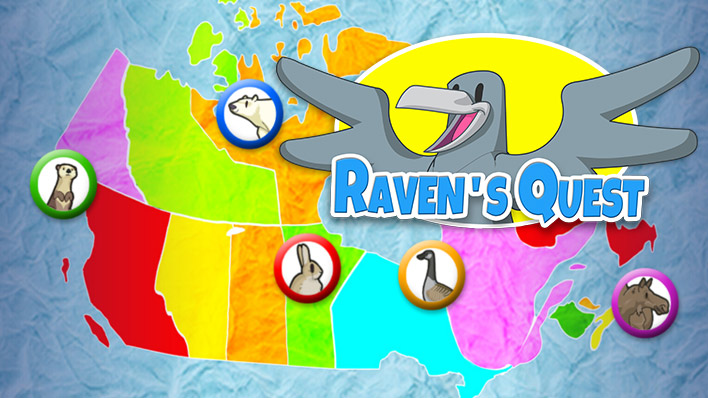
In the following game called Raven’s Quest, we visit different provinces and territories, and solve problems.
- Choose three (3) of the regions from Raven’s Quest
- Describe the environment in each region. For example, what types of land, plants, and animals characterize the region?
Use a method of your choice to record your answers.
It’s time to play a game! You will now access Raven’s Quest.
Mapping Indigenous Nations on Turtle Island
Now that we have considered the different physiographic regions of Canada, let’s turn our attention to the many Indigenous communities that lived in this region before the 1700s (and continue to live today), and how these regions affected their relationship with the land.
Indigenous communities have lived on Turtle Island, the land that is now Canada, since time immemorial (time extending beyond the reach of living memory or recorded history). Only in the last 500 years did a large population of settlers from other continents come to live on this land. Before European contact, there were hundreds of Indigenous nations.
Before European contact, there were no formal borders like there are today. Instead, there were guidelines shared between communities about how and where people travelled, hunted, and lived so that they would not interfere with each other. These guidelines were especially important in regions with limited food sources, like the Arctic.
Some Indigenous nations share a common language, teachings, and traditions, and were part of larger communities that included many smaller nations. The Haudenosaunee and the Anishinaabe are examples of large nations that contained many smaller nations.
Both the Haudenosaunee and the Anishinaabe formed alliances and political unions based on this history in their territories, such as the Haudenosaunee Confederacy and the Three Fires Confederacy.
Haudenosaunee Territory
This map includes the First Nations communities that were a part of the Haudenosaunee Confederacy and where these Nations live today. The five Nations in the Confederacy are listed at the bottom of the map.
- Mohawks
- Oneidas
- Onondagas
- Cayugas
- Senecas
Notice their historic territories found in the dotted lines in the map.
 Description
This map shows where the Six Nations of the Haudenosaunee were relocated to by the British Crown.
The Six Nations displayed on the map are: Tuscarora, Seneca, Cayuga, Onondaga, Oneida, and Mohawk.
There are 10 areas noted on the map that are the current territory of the Haudenosaunee. They are Gibson, Tyendinega, Ahkwesahsne, Kanehsatake, Kanawake, Ganienkeh, Allegheny, Cattaragus, Tonawanda, and Kanatsiohareke.
Map Disclaimer: As we work towards Truth and Reconciliation, information about lands and territories is constantly being updated. This map was accessed through the permission terms of Two Row Wampum Renewal Campaign in June 2024.
What physiographic region are these territories closest to? What are some considerations that these nation(s) would have to take living in this region? Record your ideas in a method of your choice.
Press Hint to access prompts to help you answer the question.
Consider the following aspects within this region:
- Climate: what is the climate like in this area?
- Physical features of the land: what is the physical environment like in this area?
- Animals: what animals are found in this area?
- Food: what kind of vegetation is found in this area? Are there many animals to hunt?
- Transportation: how would the communities or groups travel in this area based on what the environment is like?
- Remember: we are considering hunting and travel in the 1700s, not now.
The Anishinaabe Peoples
The Odawa, Chippewa (Ojibwe and Saulteaux respectively), Oji-Cree, Mississaugas, Algonquin, Nipissing, and Potawatomi, are all part of the Anishinaabe peoples who focused on hunting, gathering, and fishing as a mainstay for food.
Each nation lived in regions with their own unique physical geography and climate, which affected their travel, hunting, fishing, and harvesting. Their territories were and are vast and can differ greatly from region to region.
Map activity
This map includes the First Nations communities that make up the Anishinaabeg territory.

Map Disclaimer: As we work towards Truth and Reconciliation, information about lands and territories is constantly being updated. This map was accessed through the permission terms of ARP Books in June 2024.
What physiographic region are these territories closest to? What are some considerations that these nation(s) would have to take living in this region? Record your ideas in a method of your choice.
Press Hint to access prompts to help you answer the question.
Consider the following aspects within this region:
- Climate: what is the climate like in this area?
- Physical features of the land: what is the physical environment like in this area?
- Animals: what animals are found in this area?
- Food: what kind of vegetation is found in this area? Are there many animals to hunt?
- Transportation: how would the communities or groups travel in this area based on what the environment is like?
- Remember: we are considering hunting and travel in the 1700s, not now.
Your task
Find a map of your community that shows where it can be found in Ontario.
What Indigenous communities live or have lived in your area? Find a trusted adult to help you learn more about one of these communities. Can you find information from the community themselves to help you?
Can you locate the traditional territory of this community? If so, use a dotted line to add this territory to your map.
Use your map, the information about the Indigenous community, the Raven’s Quest game, and the information about the physiographic regions to fill in the following characteristics of your local community using a method of your choice or the organizer found here.
- Indigenous community
- Physiographic region
- Climate
- Vegetation
- Physical features
- Animals
Complete the Selected Region Elements activity in your notebook or using the following fillable and printable document. You can also use a method of your choice to complete the activity.
| General elements | Your region’s elements |
|---|---|
| Selected Indigenous community |
|
| Physiographic region name |
|
| Climate |
|
| Vegetation |
|
| Physical features |
|
| Animals |
|
Press the ‘Activity’ button to access the Selected Region Elements.
Consolidation
Using a map of Canada

In the Action section, you explored the location of a few Indigenous communities that lived on this land before European contact and who continue to live in these communities today.
Use this blank map of Ontario to show what you have learned about your local community and the Indigenous Nations who lived here before you.

Use this checklist to help you include all of the needed information on the map:
Create a checklist:
- Show the physiographic region of your community
- Add the names of at least one Indigenous community who lived and/or live in your community
- Show where your community is found
- Add the name of your community to the map
Reflection
As you read through these descriptions, which sentence best describes how you are feeling about your understanding of this learning activity? Press the button that is beside this sentence.
I feel...
Now, record your ideas using a voice recorder, speech-to-text, or writing tool.