Minds On
Climate
How do you decide what clothes you need to wear?
What information can you use to help you decide what to wear?
Press ‘Hint’ to explore ideas about what clothes to wear.
Consider the two types of weather:
- warm, sunny weather
- cold, snowy weather
Let’s sort some clothing for warm, sunny weather and for cold, snowy weather. What are the most appropriate types of clothing for these two types of weather?
Sort the following items of clothing and decide which is for warm or cold weather.
Press the Answer button to find out which clothes are for warm and cold weather.
| Type of clothing | Type of weather |
|---|---|
| Mittens | cold |
| Sun hat | warm |
| Wool hat | cold |
| Snow pants | cold |
| Scarf | cold |
| Shorts | warm |
| Winter jacket | cold |
| Swimsuit | warm |
| Sweater | cold |
| T-shirt | warm |
Action
Seasons and clothing
Brainstorm
What do you think?
Reflect on the following questions:
- Do you check the weather before getting ready for school? Why?
- How do you think climate relates to clothing?
Record your ideas in a notebook or a method of your choice.
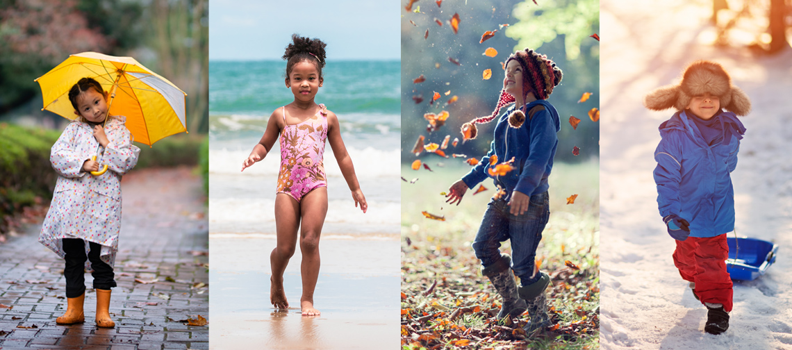
Four seasons
The four seasons are spring, summer, fall, and winter.
- Think of the different clothing someone might wear for each of these seasons.
- List the types of clothing someone could wear by season, because of weather.
Complete the Different Clothing for Different Seasons activity in your notebook or using the following fillable and printable document. You can also use another method of your choice.
| Seasons | Clothing people could wear |
|---|---|
| Spring | |
| Summer | |
| Fall | |
| Winter |
Press the ‘Activity’ button to access the Different Clothing for Different Seasons activity.
Clothing for diverse climates

Examine the following descriptions of different climates from around the world. As you explore the descriptions, consider the following questions about clothing.
- What clothing might someone need for each climate that is described?
- Why do you think so?
- Where in the world could the climate described be located?
Record your ideas in a notebook or a method of your choice.
Press ‘Hint’ to consider a few questions that relate to different kinds of weather.
The following photo is of a tropical beach as the sun goes down behind the palm trees. The climate is hot all year round.

Where in the world might the tropical beach be located?
Press ‘Answer’ to explore where it may be located.
The tropical beach you explored is in Guarajuba Bahia, Brazil. Brazil is in the north half of South America. Check out Brazil on the following world map.

The image is a map of the world with the 7 continents labelled: North America, South America, Europe, Asia, Africa, Australia & Oceania and Antarctica. The 5 oceans are also labelled (Atlantic Ocean, Pacific Ocean, Southern Ocean, Indian Ocean and Arctic Ocean). A few other areas of this map are labelled, such as the Caribbean which is in the Atlantic Ocean under North America. Central America is also labelled, which is the land between North America and South America. The Middle East is labelled in the South and West portion of Asia. An arrow is pointing to Brazil which is in the north half of South America.
The following photo is of a tropical cloud forest, where the tropical forest is dense and covered in fog. The cloud forest is hot and humid all year long.
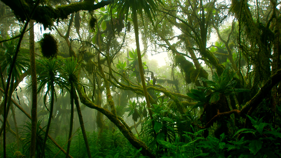
Where in the world might the tropical cloud forest be located?
Press ‘Answer’ to explore where it may be located.
The tropical cloud forest is found in the rainforests of the Democratic Republic of Congo. Check out the Democratic Republic of Congo on the following world map.

The image is a map of the world with the 7 continents labelled: North America, South America, Europe, Asia, Africa, Australia & Oceania and Antarctica. The 5 oceans are also labelled (Atlantic Ocean, Pacific Ocean, Southern Ocean, Indian Ocean and Arctic Ocean). A few other areas of this map are labelled, such as the Caribbean which is in the Atlantic Ocean under North America. Central America is also labelled, which is the land between North America and South America. The Middle East is labelled in the South and West portion of Asia. An arrow is pointing to the Democratic Republic of Congo in the center of Africa.
The following photo reveals a hot and dry landscape with palm trees on the riverbank. It is hot and dry almost all year long. There are a few months a year when it rains but the weather is still warm.
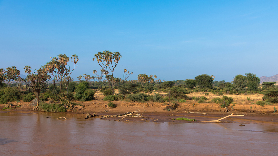
Where in the world might the hot landscape be located?
Press ‘Answer’ to explore where it may be located.
The hot and dry landscape is found in Kenya, Africa. Check out Kenya on the following world map.

The image is a map of the world with the 7 continents labelled: North America, South America, Europe, Asia, Africa, Australia & Oceania and Antarctica. The 5 oceans are also labelled (Atlantic Ocean, Pacific Ocean, Southern Ocean, Indian Ocean and Arctic Ocean). A few other areas of this map are labelled, such as the Caribbean which is in the Atlantic Ocean under North America. Central America is also labelled, which is the land between North America and South America. The Middle East is labelled in the South and West portion of Asia. An arrow is pointing to Kenya, Africa.
The following photo is of a snowy, cold climate covered in mountains and snow. It is cold and snowy all year long.
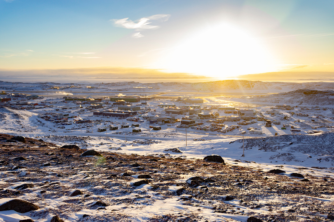
Where in the world might the snowy city be located?
Press ‘Answer’ to explore where it may be located.
The snowy city is Iqaluit, Nunavut in Northern Canada. Check out Iqaluit on the following world map.

The image is a map of the world with the 7 continents labelled: North America, South America, Europe, Asia, Africa, Australia & Oceania and Antarctica. The 5 oceans are also labelled (Atlantic Ocean, Pacific Ocean, Southern Ocean, Indian Ocean and Arctic Ocean). A few other areas of this map are labelled, such as the Caribbean which is in the Atlantic Ocean under North America. Central America is also labelled, which is the land between North America and South America. The Middle East is labelled in the South and West portion of Asia. An arrow is pointing to Iqaluit in Nunavut, Canada.
A mild climate has weather that is cool and dry, but there are different seasons. With different seasons the weather changes, which means that sometimes it can be cold and snowy, sometimes it can be rainy, and sometimes it can be hot and dry.
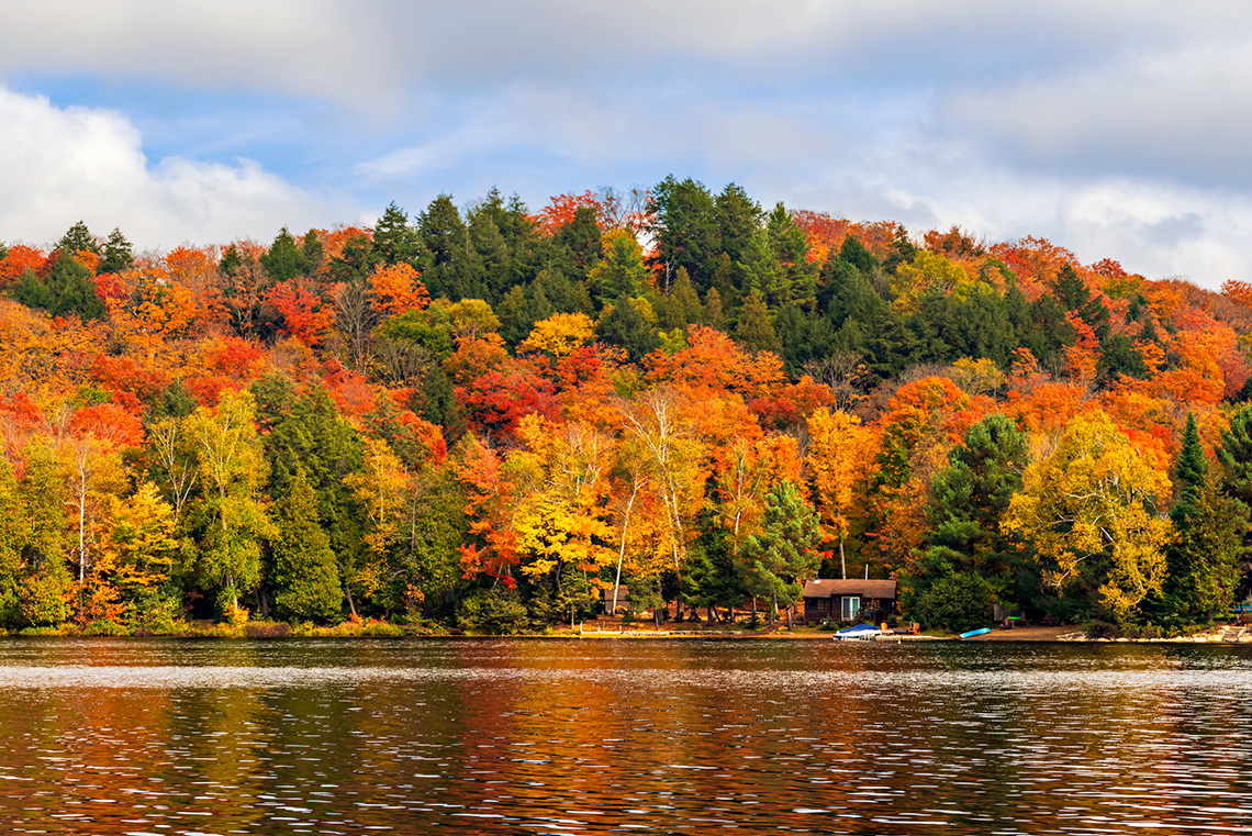
Where in the world might the forest be located?
Press ‘Answer’ to explore where it may be located.
The forest in the mild climate you explored is in Central Ontario, Canada. The following map shows an up-close, coloured section where Central Ontario, Canada is located.

The image is a map of the world with the 7 continents labelled: North America, South America, Europe, Asia, Africa, Australia & Oceania and Antarctica. The 5 oceans are also labelled (Atlantic Ocean, Pacific Ocean, Southern Ocean, Indian Ocean and Arctic Ocean). A few other areas of this map are labelled, such as the Caribbean which is in the Atlantic Ocean under North America. Central America is also labelled, which is the land between North America and South America. The Middle East is labelled in the South and West portion of Asia. An arrow is pointing to Central Ontario in Canada.
Diverse clothing from around the world

Imagine what kind of clothes are best for warm or cold climates in different places around the world.
Complete the Clothes for Warm and Cool Climates Around the World in your notebook or using the following fillable and printable document. You can also use another method of your choice.
| Description | Clothing for Warm Climate or Cold Climate? | Which Continent / Hemishpere? |
|---|---|---|
Press the ‘Activity’ button to access Clothes for Warm and Cool Climates Around the World.
Brainstorm
Share your thoughts
Reflect on the following questions:
- Which type of climate is similar to your community? How do you know?
- What is one area that has climate that is different than your community?
- How does the climate affect the clothing we wear?
Record your ideas in a notebook or a method of your choice.
Consolidation
Task: Clothing creation
Now, it’s your turn to design an outfit!
- Create an outfit appropriate for each of the four seasons in Canada.
You can draw your outfit in a notebook or another method of your choice.
- Describe how each outfit is perfect for each season!
Press the following tabs to explore the four seasons and to consider what the weather is like.
Complete the Four Seasons Outfit Organizer in your notebook or using the following fillable and printable document. You can also use another method of your choice.
|
Spring This outfit is perfect for spring because… |
Summer This outfit is perfect for summer because… |
|
Autumn This outfit is perfect for autumn because… |
Winter This outfit is perfect for winter because… |
Press the ‘Activity’ button to access the Four Seasons Outfit Organizer.
Student Success
Think-Pair-Share
If possible, share and describe your outfit designs with a partner or your teacher.
Then, consider the following questions:
- Where else in the world might people wear each of your four outfits?
- How do you know?
Record your ideas in a notebook or another method of your choice.
Note to teachers: See your teacher guide for collaboration tools, ideas and suggestions.
Reflection
How do you feel about what you have learned in this activity? Which of the next four sentences best matches how you are feeling about your learning? Press the button that is beside this sentence.
I feel...
Now, record your ideas about your feelings using a voice recorder, speech-to-text, or writing tool.