Minds On
Canada and the world
Canada is one of many countries in the world. Explore the following world map.

A map of all the countries in the world. A horizontal line across the centre of the map represents the equator. Above the equator is the northern hemisphere, and below the equator is the southern hemisphere. A vertical line across the map passing through London, England and Accra, Ghana represents the prime meridian. Right of the prime meridian is the eastern hemisphere, and left of the prime meridian is the western hemisphere. Canada is located in the northern part of the continent of North America. Canada has a southern border and a north-western border with the United States of America. Canada has coasts on the Pacific, Arctic, and Atlantic Oceans. Greenland is north-east of Canada in the Atlantic Ocean. The continent of Europe is east of Canada across the Atlantic Ocean. Russia is west of Canada across the Pacific Ocean, and also north of Canada across the Arctic Ocean.
Brainstorm
Where is Canada?
Describe Canada’s location in as many ways as you can.
Use the cardinal directions (north, east, south, and west) and consider the following questions:
- Which hemisphere is Canada in?
- Which continent is Canada on?
- Which oceans surround Canada?
- Which countries are near Canada?
Record your ideas orally, digitally, in print, or in a method of your choice.
Explore the following video about Canada and its place in the world. Add any new information that you learn to your brainstorm.
Action
Canada’s provinces and territories
Canada is divided into ten provinces and three territories.
Explore the following video about Canada’s provinces and territories. Note how many there are, their names, and their locations in a method of your choice.
Identifying Canada’s provinces and territories
Let’s identify the location of Canada’s ten provinces and three territories. You can review the previous video and your notes to help you.
Complete the Canada’s Provinces and Territories activity in your notebook, in the following fillable and printable documents, or in a method of your choice.
Press the ‘Activity’ button to access Canada’s Provinces and Territories.
 Description
This is an unlabelled Map of Canada’s Provinces and Territories.
It is a map of Canada with numbered boxes for identifying each province and territory.
Box one labels the most western territory in Northern Canada.
Box two labels the central territory in Northern Canada.
Box three labels the most eastern territory in Northern Canada.
Box four labels the most western province in Canada.
Box five labels the most western province in the Prairies.
Box six labels the central province in the Prairies.
Box seven labels the most eastern province in the Prairies.
Box eight labels the most western province in Central Canada.
Box nine labels the most eastern province in Central Canada.
Box ten labels the most northern province in Atlantic Canada.
Box eleven labels the province that is a small island in Atlantic Canada.
Box twelve labels the most southwestern province in Atlantic Canada.
Box thirteen labels the most southeastern province in Atlantic Canada.
British Columbia and Manitoba
British Columbia is the most western province in Canada, and Manitoba is the most eastern province in the Prairies. Let’s explore some more facts about these two provinces of Canada.
Press each tab to access facts about British Columbia and Manitoba.
- British Columbia joined Canada in 1871.
- The capital city of British Columbia is Victoria, and the largest city in British Columbia is Vancouver.
- British Columbia is on the coast of the Pacific Ocean.
- British Columbia shares its eastern border with Alberta, and shares its northern border with the Yukon and the Northwest Territories.
- Forestry is a major industry in British Columbia.
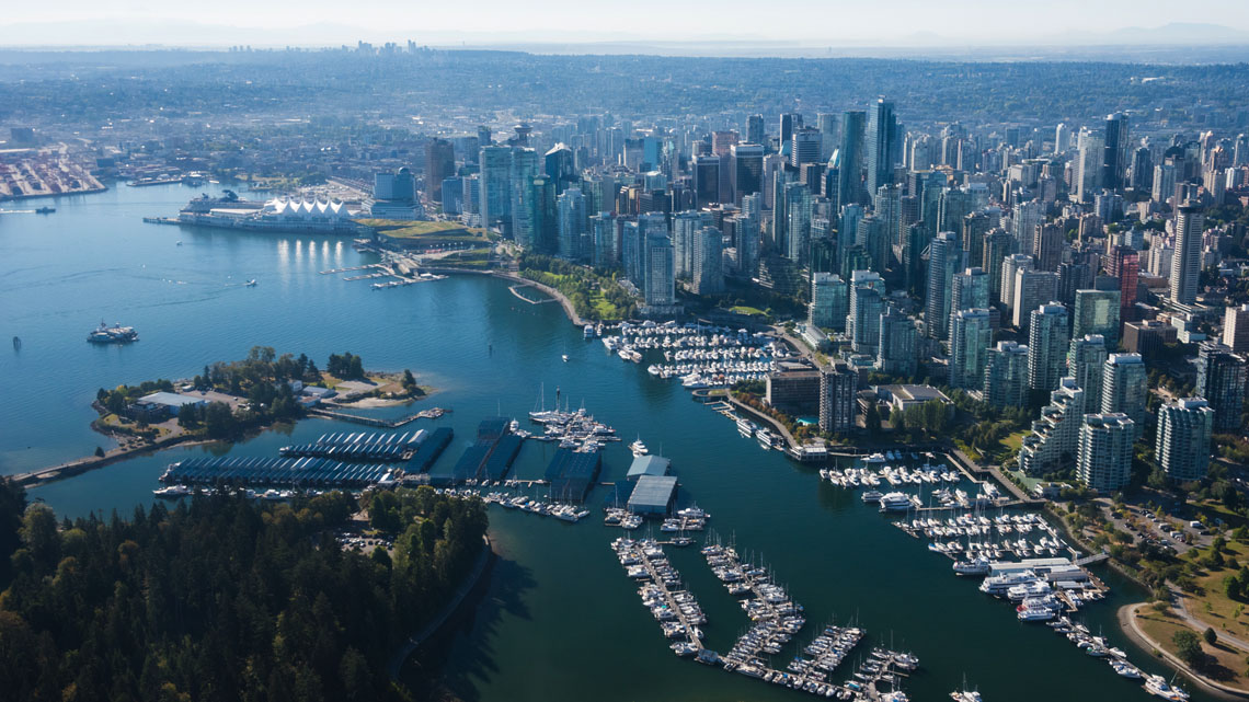
Downtown Vancouver
- Manitoba joined Canada in 1870.
- The capital of Manitoba is Winnipeg, it is also Manitoba’s largest city.
- Manitoba is one of three Prairie provinces.
- Manitoba shares its western border with Saskatchewan, shares its eastern border with Ontario, and shares its norther border with Nunavut.
- Farming is a major industry in Manitoba.
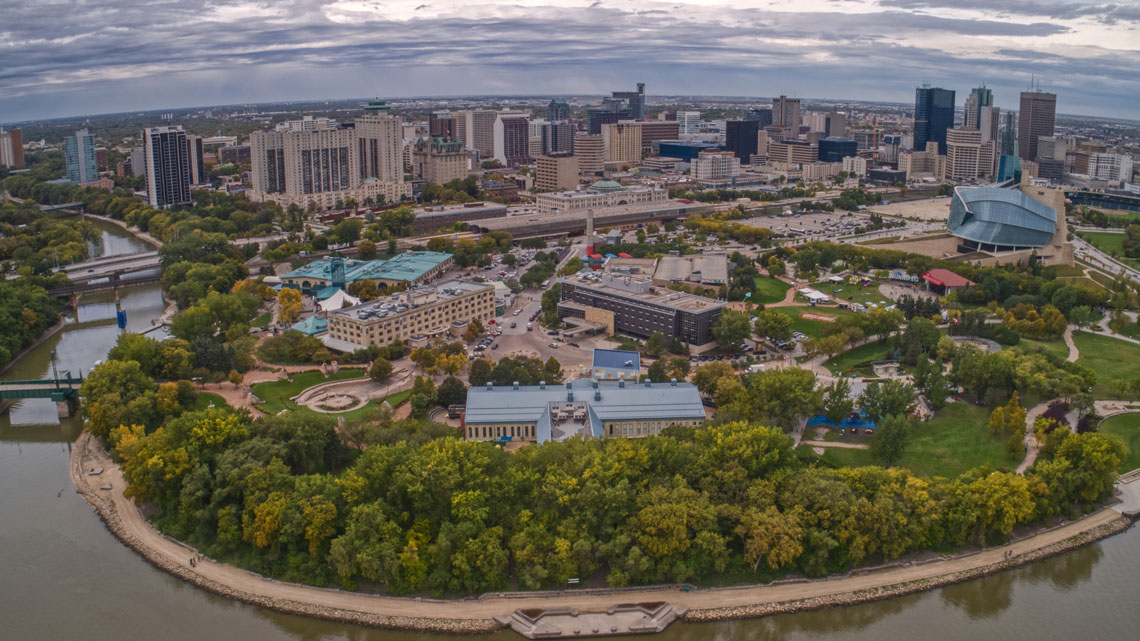
Downtown Winnipeg
Review the following statements and select if they are true or false.
Intermediate directions
Explore the following compass rose.
 Description
An eight-pointed star centred in a circle representing the four cardinal directions and the four intermediate directions. There are forty-five degrees between each point of the compass rose. Starting at the top point of the compass rose and moving clockwise, the directions are labelled: N (North), NE (Northeast), E (East), SE (Southeast), S (South), SW (Southwest), W (West), and NW (Northwest).
Before we continue exploring Canada’s capital cities, let’s review how directions are represented on maps.
On some maps, directions are represented using a compass rose. A compass rose shows four main directions. These are called cardinal directions.
|
Cardinal Directions |
|||
|
North (N) |
East (E) |
South (S) |
West (W) |
A compass rose can also show intermediate directions. These are the directions that are halfway between the main cardinal directions.
|
Intermediate Directions |
|
|
Northeast (NE) |
Halfway between North and East |
|
Southeast (SE) |
Halfway between South and East |
|
Southwest (SW) |
Halfway between South and West |
|
Northwest (NW) |
Halfway between North and West |
Canada’s capital cities
We have learned about where the provinces and territories of Canada are located. Now let’s learn about their capital cities.
A capital city is a city where the government’s offices are located.
Every province and territory has a capital city. Countries also have capital cities. Canada’s capital city is Ottawa, which is located in Ontario.
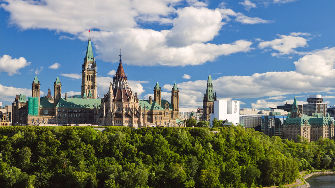
The offices of Canada’s government are located on Parliament Hill in Ottawa, Ontario.
Explore the following video about the capital cities of Canada’s provinces and territories.
Identifying Canada’s capital cities
Explore the following map of the capital cites of Canada’s provinces and territories. Do you know the capital city of Ontario? Can you locate it?
 Description
The Capital Cities of Canada
A map of Canada with the capital cities of provinces and territories labelled.
The capital city of the Yukon is Whitehorse. Whitehorse is located in the southwestern part of the Yukon.
The capital city of the Northwest Territories is Yellowknife. Yellowknife is located in the south-central part of the Northwest Territories, on the north coast of Great Slave Lake.
The capital city of Nunavut is Iqaluit. Iqaluit is located in the southeastern part of Nunavut, on the southeast coast of Baffin Island in the Atlantic Ocean.
The capital city of British Columbia is Victoria. Victoria is located in the southern part of British Columbia, on the southeast coast of Vancouver Island in the Pacific Ocean.
The capital city of Alberta is Edmonton. Edmonton is located in the centre of Alberta.
The capital city of Saskatchewan is Regina. Regina is located in the southern part of Saskatchewan.
The capital city of Manitoba is Winnipeg. Winnipeg is located in the southern part of Manitoba.
The capital city of Ontario is Toronto. Toronto is located in the southern part of Ontario, on the north coast of Lake Ontario.
The capital city of Canada is Ottawa. Ottawa is located in the southeastern part of Ontario, on the border with Quebec.
The capital city of Quebec is Quebec City. Quebec City is located in southeastern part of Quebec, on the bank of the St. Lawrence River.
The capital city of Newfoundland and Labrador is St. John’s. St. John’s is located on the northeast coast of Newfoundland in the Atlantic Ocean.
The capital city of Prince Edward Island is Charlottetown. Charlottetown is located on the south-central coast of Prince Edward Island in the Atlantic Ocean.
The capital city of New Brunswick is Fredericton. Fredericton is located in the centre of New Brunswick.
The capital city of Nova Scotia is Halifax. Halifax is located in the east-central part of Nova Scotia, on the coast of the Atlantic Ocean.
Let’s practice using cardinal and intermediate directions to describe the direction we would travel on a trip between two of Canada’s capital cities. Here are some examples:
Consolidation
Comparing Canada’s provinces and territories
Nova Scotia is the most southeastern province in Atlantic Canada. Let’s explore some more facts about this province.
- Nova Scotia joined Canada in 1867.
- The capital city of Nova Scotia is Halifax. It is also Nova Scotia’s largest city.
- Nova Scotia is on the coast of the Atlantic Ocean.
- Nova Scotia shares its western border with New Brunswick.
- Fishing is a major industry in Nova Scotia.
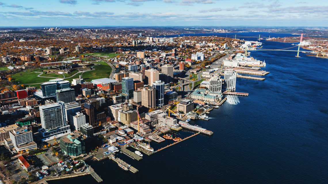
Downtown Halifax
We are now going to compare and contrast two of Canada’s provinces and territories.
Use the provinces we have explored in this learning activity (British Columbia, Manitoba, and Nova Scotia). You can also research other provinces and territories of your choice. Begin your search by exploring government websites, the Canadian Encyclopedia, or resources created by the Royal Canadian Geographical Society.
Complete the Comparing Provinces and Territories Venn Diagram activity in your notebook, in the following fillable and printable documents, or in a method of your choice. Be sure to include:
- the capital city
- location of this province in Canada
- 5 interesting facts about this province
Press the ‘Activity’ button to access the Comparing Provinces and Territories Venn Diagram.
Reflection
As you read through these descriptions, which sentence best describes how you are feeling about your understanding of this learning activity? Press the button that is beside this sentence.
I feel...
Now, record your ideas using a voice recorder, speech-to-text, or writing tool.