Minds On
Canada’s natural environments

There are distinct characteristics that can be used to describe the natural environment in different areas of Canada.
Brainstorm
What do you think?
Think about the types of land that are found across Canada.
- What is the weather like in each area?
- How would you describe the ground in each area?
- What kind of plants and animals are common in each area?
- Are there any bodies of water in each area?
- How do people interact with the land in each area?
If possible, discuss with a partner and record your ideas orally, digitally, in print, or in a method of your choice.
Action
Types of regions
Explore the following maps. They are both maps of Canada, but they are not the same. What do you notice about the divisions on each map?
Press each tab to access the maps.

A map of the provinces and territories of Canada.From West to East, the territories are the Yukon, the North West Territories, and Nunavut.>From West to East, the provinces are British Columbia, Alberta, Saskatchewan, Manitoba, Ontario, Quebec, New Brunswick, Prince Edward Island, Nova Scotia, Newfoundland and Labrador.

The Arctic Lands are the most northern physical region in Canada. The Western Cordillera is the most western physical region in Canada. The Interior Plains are the second most western physical region in Canada. The Canadian Shield is a central and eastern physical region in Canada. The Hudson Bay Lowlands is a central physical region in Canada that is surrounded by the Canadian Shield. The Great Lakes-St. Lawrence Lowlands is the most southern physical region in Canada.The Appalachian Region is the most eastern physical region in Canada.
Political regions
Map one represents the political regions of Canada. This means that the map is divided by the borders between Canada’s provinces and territories.
A political region is an area of land that has their own government and leader. Ontario is an example of a political region. Can you name all the provinces and territories?
Physical regions
Map two represents the physical regions of Canada. This means that the map is divided by the naturally formed areas of Canada that have a distinct set of physical features.
A physical region is an area of land that has common landforms, such as mountains, plains, or valleys. The Canadian Shield is an example of a physical region.
Maps representing more than one type of region
Let’s explore the following map representing both the political and the physical regions of Canada.
The Arctic Lands are the most northern physical region in Canada. It covers the northern parts of the Northwest Territories and Nunavut, as well as a small part of northern Yukon. The Western Cordillera is the most western physical region in Canada. It covers most of the Yukon and British Columbia, as well as western parts of the Northwest Territories and Alberta. The Interior Plains are the second most western physical region in Canada. It covers central Northwest Territories, most of Alberta, the southern halves of Saskatchewan and Manitoba, as well as small parts of eastern Yukon and British Columbia, and western Nunavut. The Canadian Shield is the central physical region in Canada. It covers most of Quebec, Labrador, and northern Ontario, the northern halves of Saskatchewan and Manitoba, as well as the southeastern parts of the Northwest Territories and Nunavut. The Hudson Bay Lowlands is a central physical region in Canada that is surrounded by the Canadian Shield. It covers part of northern Ontario, as well as small parts of southern Nunavut, northeastern Manitoba, and western Quebec. The Great Lakes-St. Lawrence Lowlands is the most southern physical region in Canada. It covers southern Ontario, as well as small parts of southern Quebec and western Newfoundland. The Appalachian Region is the most eastern physical region in Canada. It covers New Brunswick, Nova Scotia, Prince Edward Island, most of Newfoundland, as well as a small part of eastern Quebec.
- Are the political regions and physical regions of Canada the same?
- Which physical regions are located in Ontario?
Record your ideas orally, digitally, in print, or in a method of your choice.
Press Suggested Answer to access possible answers.
1) No, the political and physical regions of Canada are not the same. Some physical regions are located in more than one political region, and some political regions contain more that one physical region.
2) The Canadian Shield, the Great Lakes-St. Lawrence Lowlands, and the Hudson Bay Lowlands are all located in Ontario
The physical regions of Canada
Explore the following accordion of the Canada’s physical regions.
Press each tab to access an image and description of that physical region.
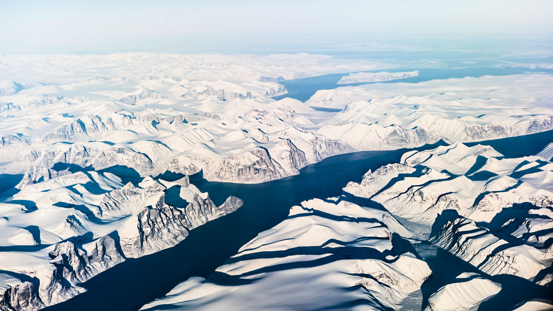
Baffin Island, Nunavut
|
The Arctic Lands |
|
|
Location |
Northern Canada, with islands in the Arctic Ocean |
|
Political Regions |
Parts of the Northwest Territories and Nunavut, as well as a small part of the Yukon |
|
Landforms |
Flat, rocky, permafrost |
|
Climate |
Short summers, long and cold winters |
|
Natural Resources |
Fossil fuels, minerals |
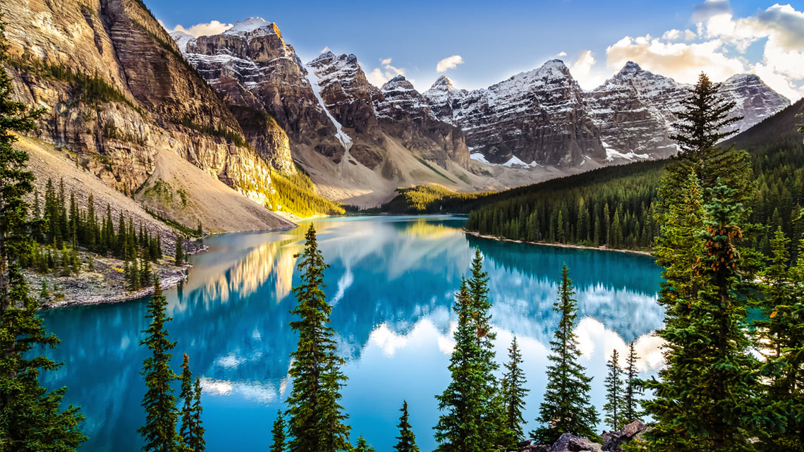
Moraine Lake, Alberta
|
The Western Cordillera |
|
|
Location |
West coast of Canada |
|
Political Regions |
Most of the Yukon and British Columbia, as well as parts of the Northwest Territories and Alberta |
|
Landforms |
Mountains, plateaus, plains, valleys |
|
Climate |
Costal: mild and wet, very little snow Interior: warm summers, cold and snowy winters |
|
Natural Resources |
Fish, forestry |
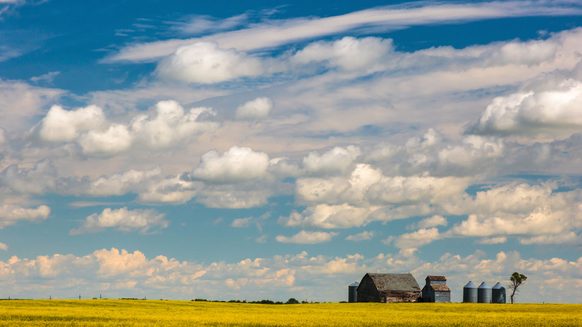
Souris, Manitoba
|
The Interior Plains |
|
|
Location |
West-central Canada |
|
Political Regions |
Most of Alberta, parts of the Northwest Territories, Saskatchewan and Manitoba, as well as small parts of the Yukon, British Columbia, and Nunavut |
|
Landforms |
Flat grassland |
|
Climate |
Hot and dry summers, very cold winters |
|
Natural Resources |
Fertile soil, fossil fuels |
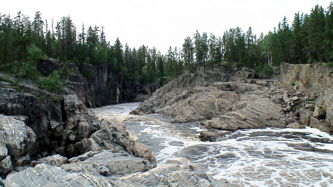
Missinaibi River, Ontario
|
The Canadian Shield |
|
|
Location |
Central and eastern Canada |
|
Political Regions |
Most of Ontario, Quebec, and Labrador, as well as parts of the Northwest Territories, Nunavut, Saskatchewan, and Manitoba |
|
Landforms |
Ancient rocks, rolling hills, small lakes |
|
Climate |
Hot summers, very cold winters |
|
Natural Resources |
Fresh water, fertile soil, forests, minerals |
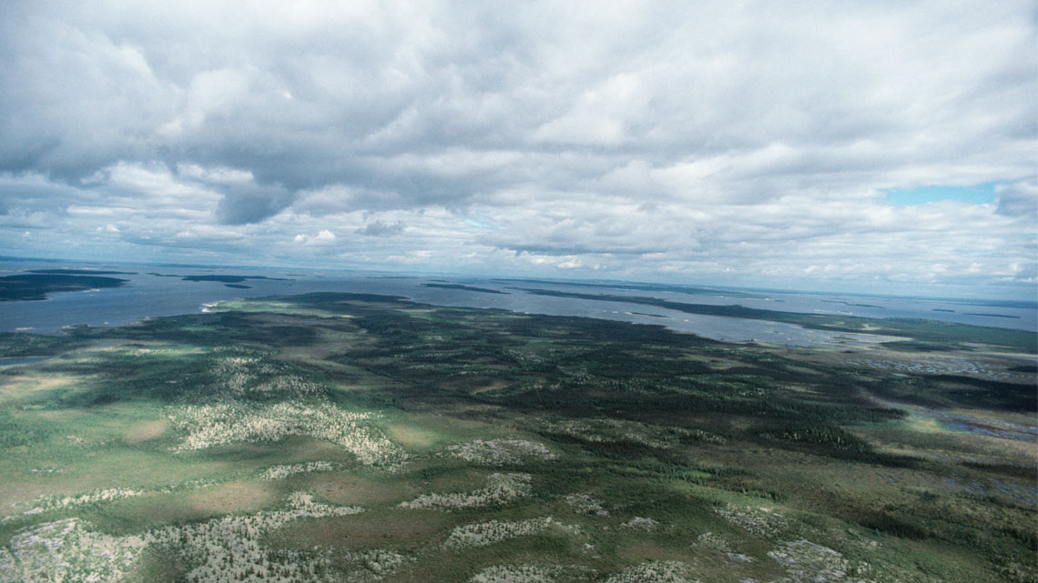
James Bay, Quebec
|
The Hudson Bay Lowlands |
|
|
Location |
Central Canada, along the coasts of Hudson Bay and James Bay |
|
Political Regions |
Part of Ontario, as well as small parts of Nunavut, Manitoba, and Quebec |
|
Landforms |
Wetlands, permafrost |
|
Climate |
Short and warm summers, long and cold winters |
|
Natural Resources |
Hydroelectricity |
Niagara, Ontario
|
The Great Lakes-St. Lawrence Lowlands |
|
|
Location |
South-eastern Canada |
|
Political Regions |
Part of Ontario, as well as small parts of Quebec and Newfoundland |
|
Landforms |
Plains, rolling hills |
|
Climate |
Warm summers, cold winters |
|
Natural Resources |
Fresh water, fertile soil, minerals |
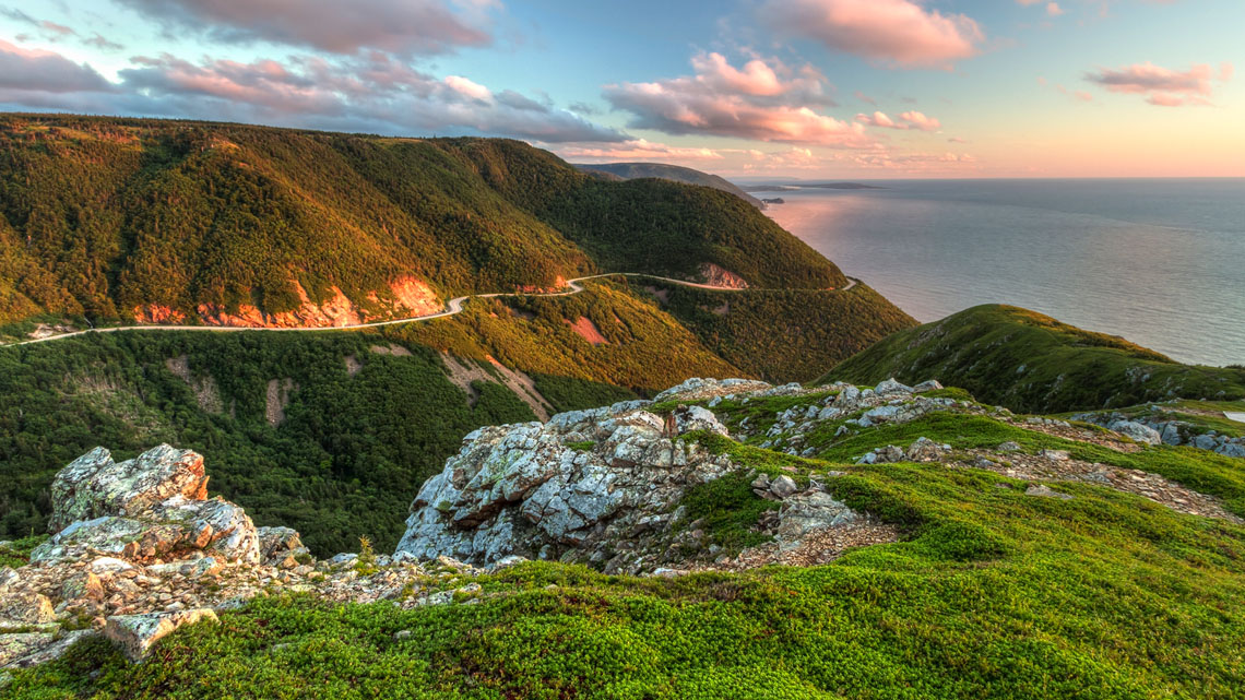
Cape Breton Highlands National Park, Nova Scotia
|
The Appalachian Region |
|
|
Location |
East coast of Canada |
|
Political Regions |
New Brunswick, Nova Scotia, Prince Edward Island, most of Newfoundland, as well as a small part of Quebec |
|
Landforms |
Rolling hills |
|
Climate |
Wet and mild, long winters |
|
Natural Resources |
Fish |
- What characteristics define a physical region?
- What are the differences in climate between the east and west coasts of Canada?
Record your ideas orally, digitally, in print or in a method of your choice.
Consolidation
Sharing information about Canada’s physical regions
Now that we have learned about the physical regions of Canada, choose one physical region to share information about.
Think of a creative way to present information about the physical region you have chosen. You can create:
|
An audio or video recording |
A brochure |
A collage or drawing |
|
A flyer or poster |
A slide show |
Another method of your choice |

Use the information about Canada’s physical regions from this learning activity to make your presentation. You can also do some independent research. Begin your search by exploring government websites, the Canadian Encyclopedia, or resources created by the Royal Canadian Geographical Society.
Sharing information checklist
Make sure that you include the following information:
Reflection
As you read through these descriptions, which sentence best describes how you are feeling about your understanding of this learning activity? Press the button that is beside this sentence.
I feel...
Now, record your ideas using a voice recorder, speech-to-text, or writing tool.