Minds On
Landforms
There are many types of landforms found in Canada.
Brainstorm
What is a landform?

- When you think about the word landforms, what comes to your mind?
- List as many landforms as you can think of.
Record your responses using a method of you choice.
Action
Physical regions

There are different physical regions of Canada with unique characteristics that define each area. Landforms and natural resources are two characteristics that distinguish physical regions.
As we go through our Action activities, complete the Physical Region Characteristics Table activity in your notebook, in the following fillable and printable documents, or in a method of your choice.
|
Physical Region |
Landforms |
Natural Resources |
|---|---|---|
|
Arctic lands |
||
|
Western cordillera |
||
|
Interior plains |
||
|
Canadian shield |
||
|
Hudson Bay lowlands |
||
|
Great Lakes-St. Lawrence lowlands |
||
|
Appalachian region |
Press the ‘Activity’ button to access Physical Region Characteristics Table.
Landforms
Landforms are one characteristic that distinguish physical regions. Landforms can be created in a few years or over a million years!
Review the following table of landforms and their defining characteristics:
|
Mountain |
a raised area of land that is very tall and rocky |
|
Plateau |
a raised area of land that is flat and has a steep drop on at least one side |
|
Hill |
a raised area of land that is not as tall as a mountain |
|
Plain |
a large area of flat land |
|
Valley |
a low area of land between hills or mountains |
|
Desert |
a dry area of land that gets very little rain |
Landforms in Canada
Explore the following carousel of landforms that can be found in Canada’s physical regions.
As you explore the following carousel, remember to take notes about landforms in your Physical Region Characteristics Table.
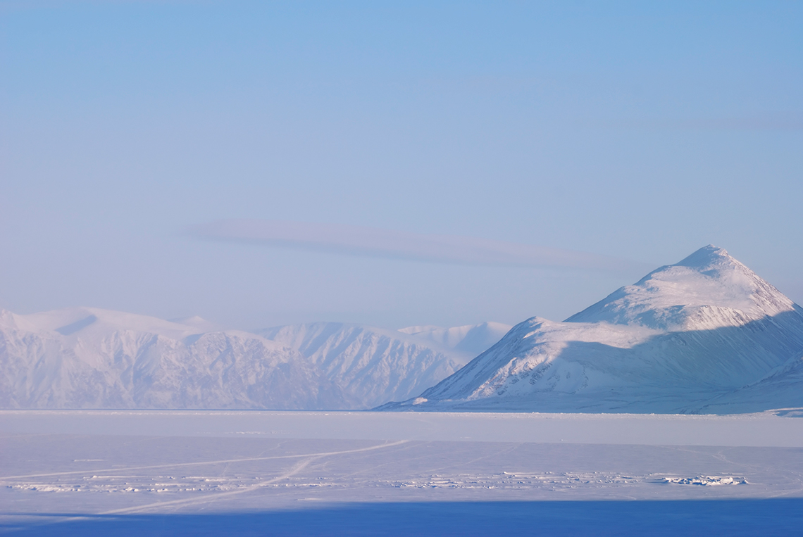
The Arctic Lands contain rocky hills and plains covered in permafrost. This is an image of the Arctic Lands in Pond Inlet, Nunavut.
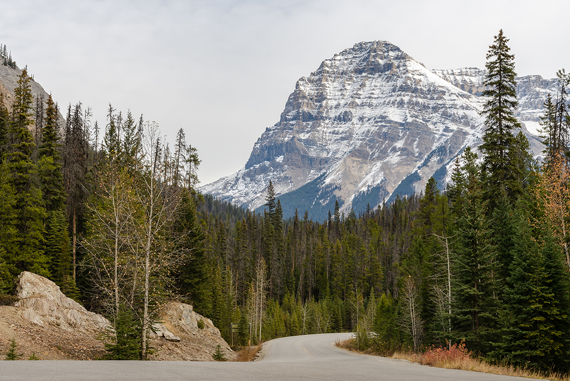
The Western Cordillera contains valleys, plains, plateaus, and rugged mountains like the Rocky Mountains. This is an image of the Western Cordillera in Yoho National Park, British Columbia.
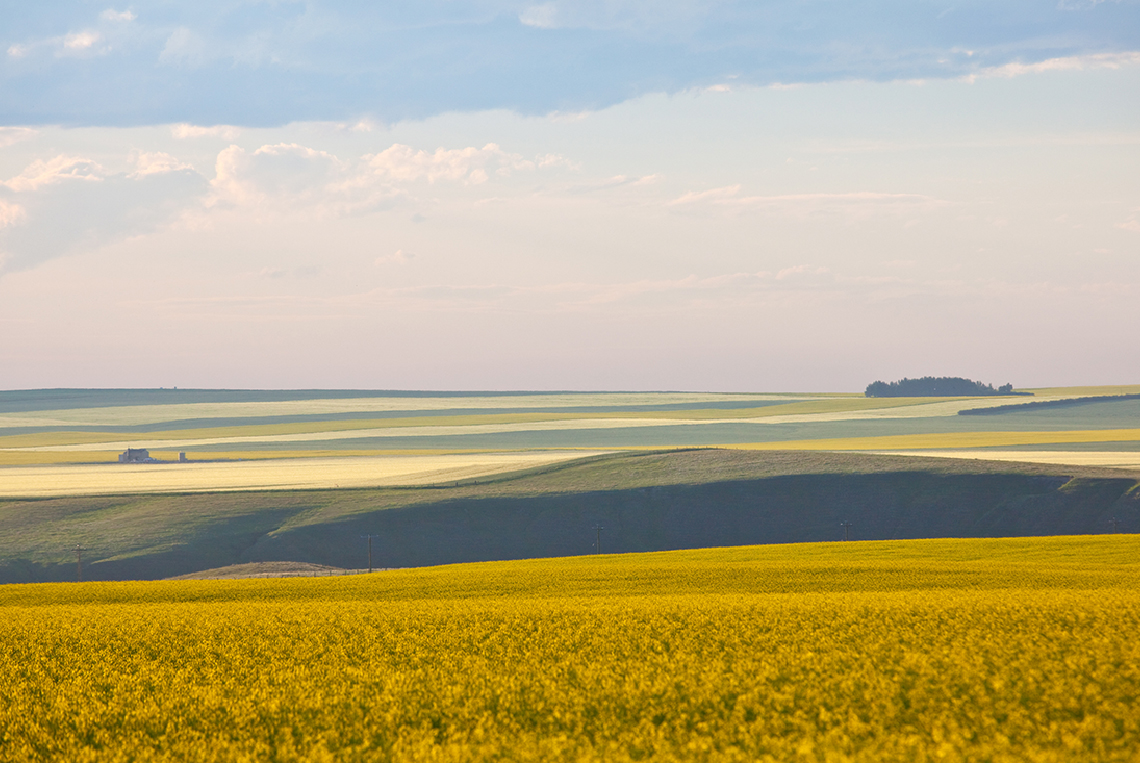
The Interior Plains contain flat grasslands, hills, low mountains, and forests. This is an image of the Interior Plains in southern Alberta.
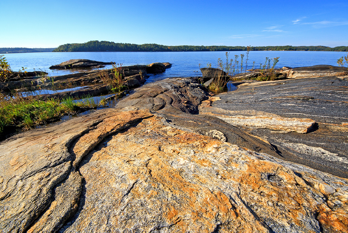
The Canadian Shield contains some of the oldest rocks on Earth, rolling hills, forests, and many small lakes. This is an image of the Canadian Shield in Georgian Bay, Ontario.
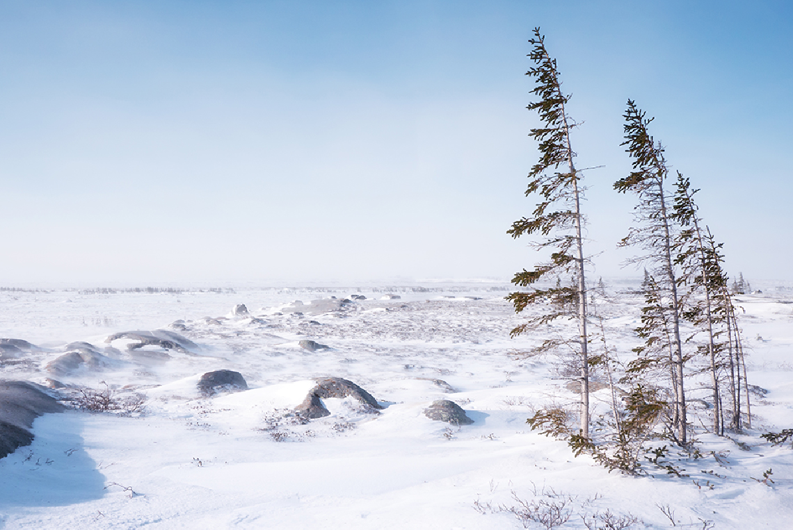
The Hudson Bay Lowlands contain plateaus, plains, and wetland covered in permafrost. This is an image of the Hudson Bay Lowlands in Churchill, Manitoba.
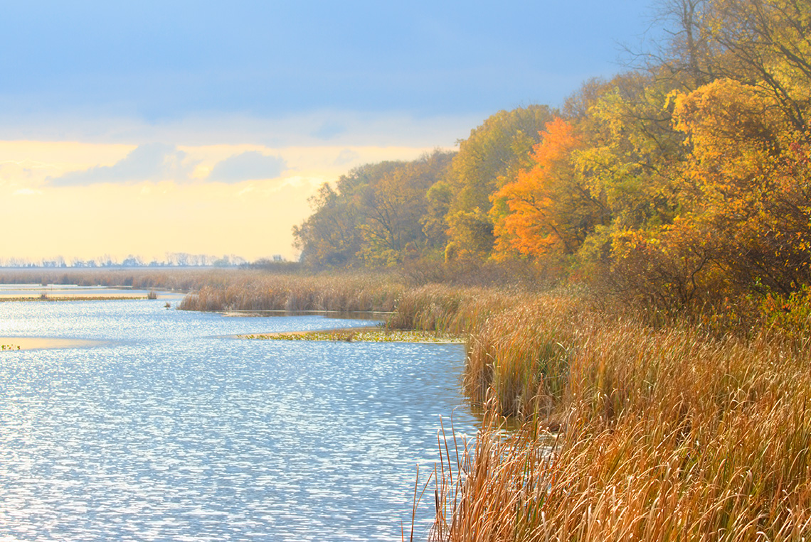
The Great Lakes-St. Lawrence Lowlands contain plains and some rolling hills. This is an image of the Great Lakes-St. Lawrence Lowlands in Point Pelee National Park, Ontario.
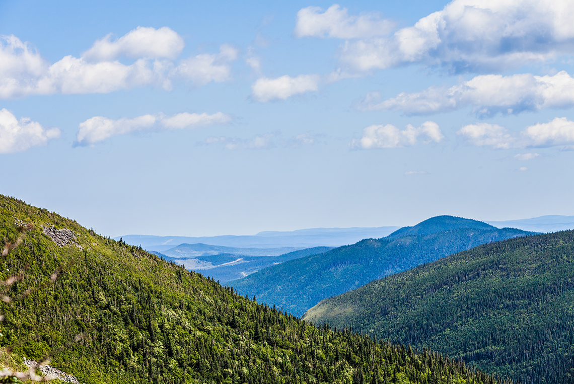
The Appalachian Region contains valleys, rolling hills, and tree-covered mountains. This is an image of the Appalachian Region in Gaspésie National Park, Quebec.
Identifying landforms
Use the previous carousel of landforms to complete the following matching activities.
For each physical region of Canada, select the group of landforms that are found in that physical region:
Now, for each group of landforms, select the physical region of Canada where those landforms can be found:
Let’s explore a video in which we meet Kajsa, a Haida Gwaii girl from Skidegate, British Columbia.
- What landform did you notice in Kajsa’s community?
Press Suggested Answer to check out a possible answer.
Natural resources
Natural resources are another characteristic that distinguish physical regions. Some natural resources are renewable, while other natural resources are not renewable.
Review the following table of natural resources:
|
Coal |
A non-renewable fossil fuel used for generating electricity |
|
Fish |
A renewable source of food used for nourishment |
|
Forests |
A renewable source of wood used for fuel, construction, and paper products |
|
Iron |
A non-renewable mineral used for construction and making steel |
|
Nickel |
A non-renewable mineral used for making metals and batteries |
|
Oil |
A non-renewable fossil fuel used for powering machines and generating electricity |
|
Water |
A renewable source of water used for nourishment, industry, and generating electricity |
Explore the following carousel of natural resources that can be found in Canada’s physical regions.
As you explore the following carousel, remember to take notes about natural resources in your Physical Region Characteristics Table.
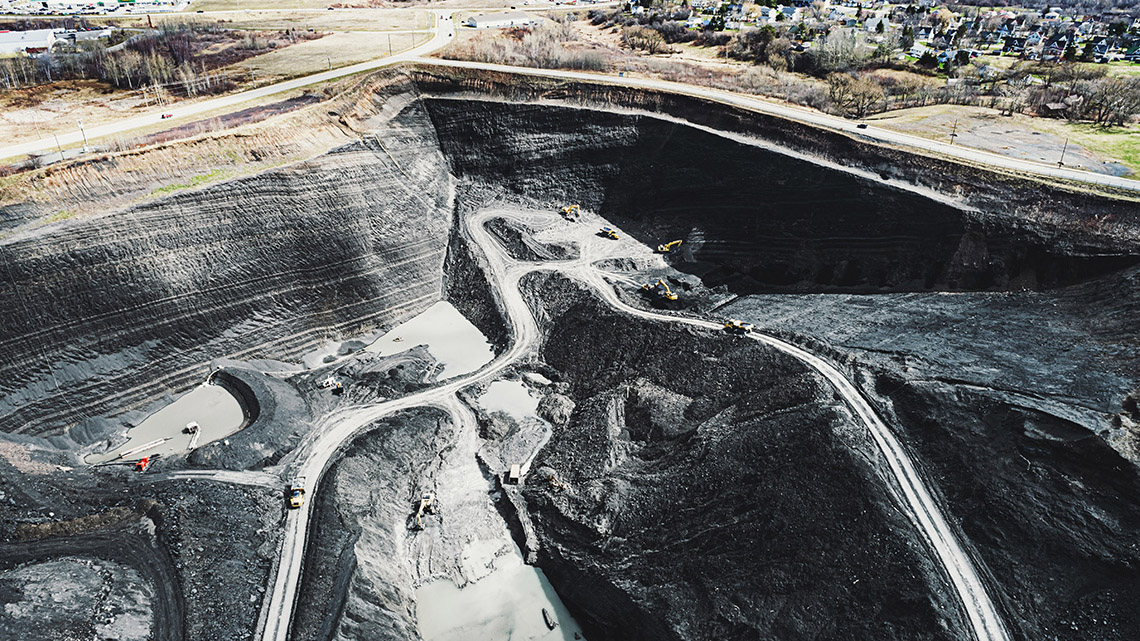
Coal mining takes place in the Western Cordillera, the Interior Plains, and the Appalachian Region. This is an image of a coal mine in Nova Scotia.
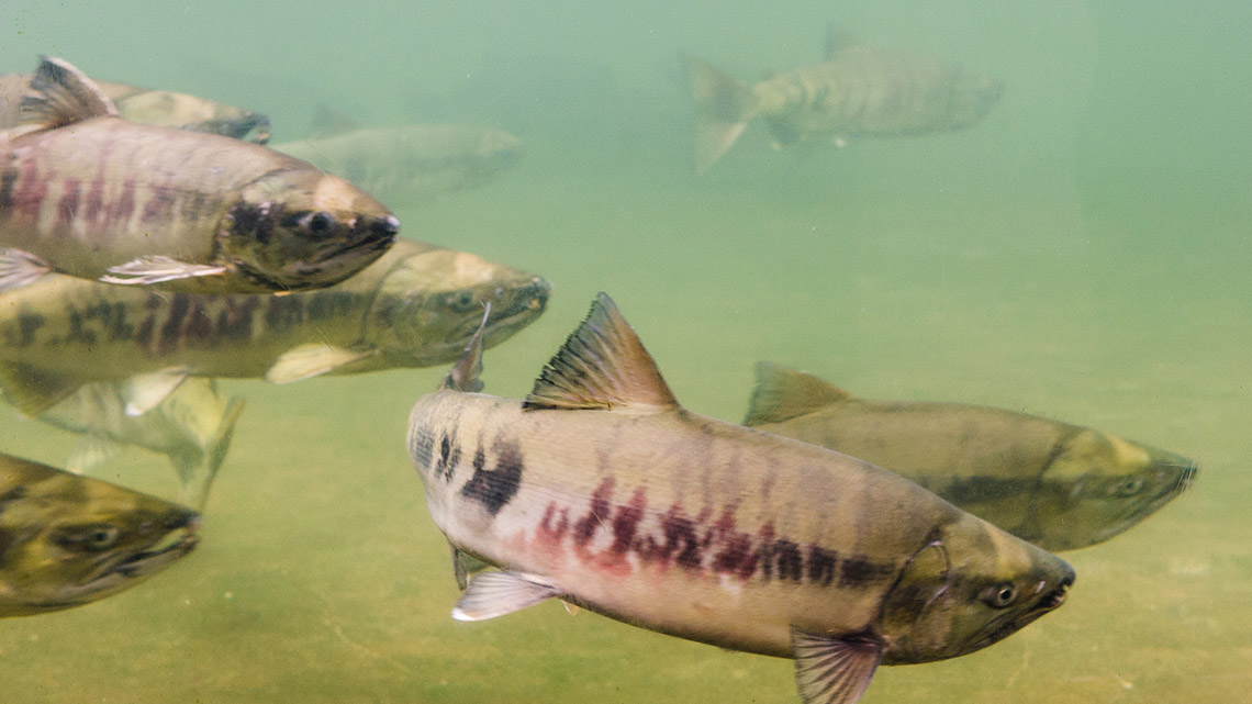
Large fish stocks are found in the Arctic Lands, the Western Cordillera, the Canadian Shield, the Great Lakes-St. Lawrence Lowlands, and the Appalachian Region. This is an image of salmon in the Yukon.
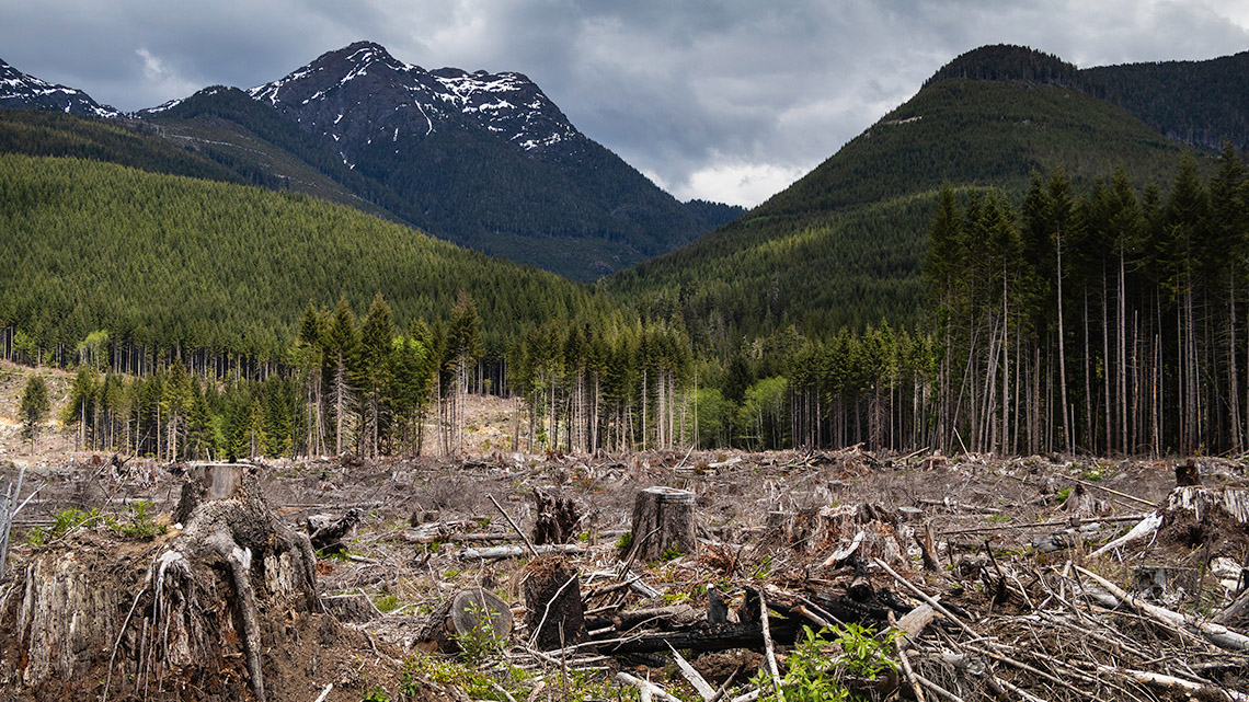
Logging takes place in the Western Cordillera, the Interior Plains, the Canadian Shield, the Great Lakes-St. Lawrence Lowlands, and the Appalachian Region. This is an image of a clear-cut forest in British Columbia.
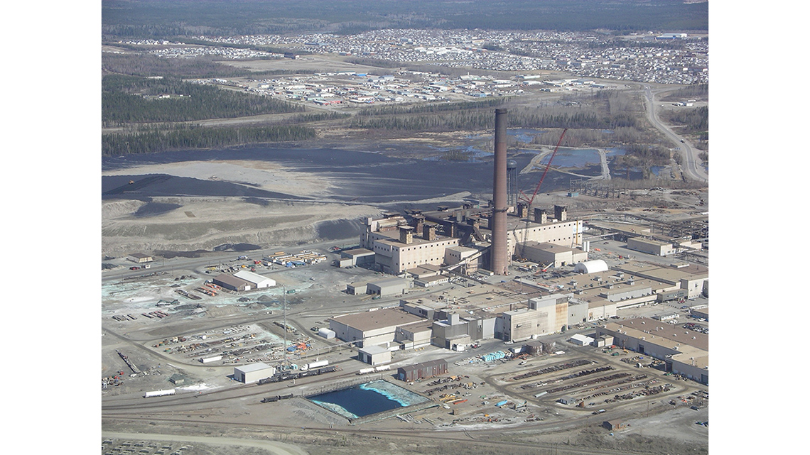
Iron mining takes place in the Arctic Region and the Canadian Shield. This is an image of an iron mine in Quebec.
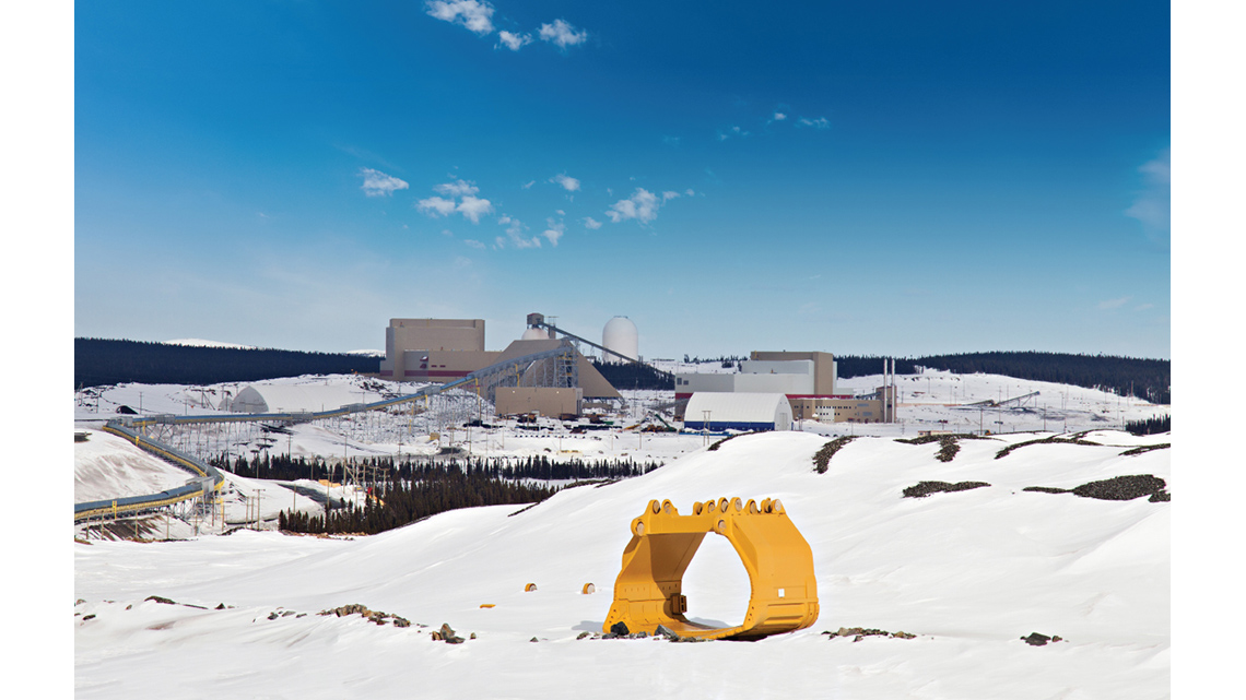
Nickel mining takes place in the Canadian Shield. This is an image of a nickel mine in Ontario.
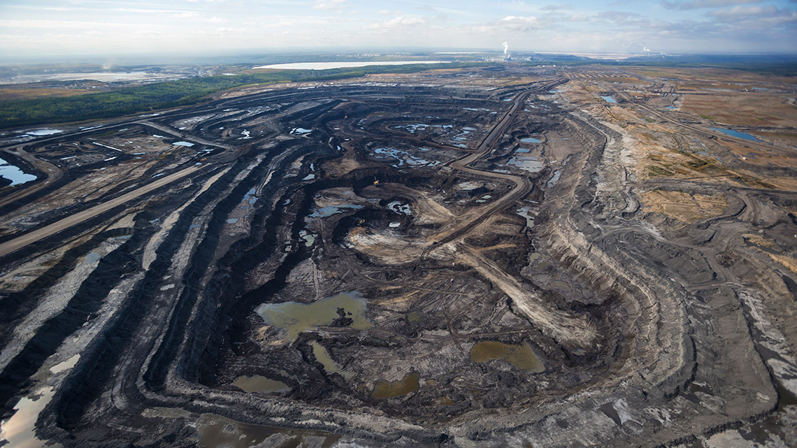
Oil is extracted in the Interior Plains and off the coast of the Appalachian Region. This is an image of an oil sands mine in Alberta.
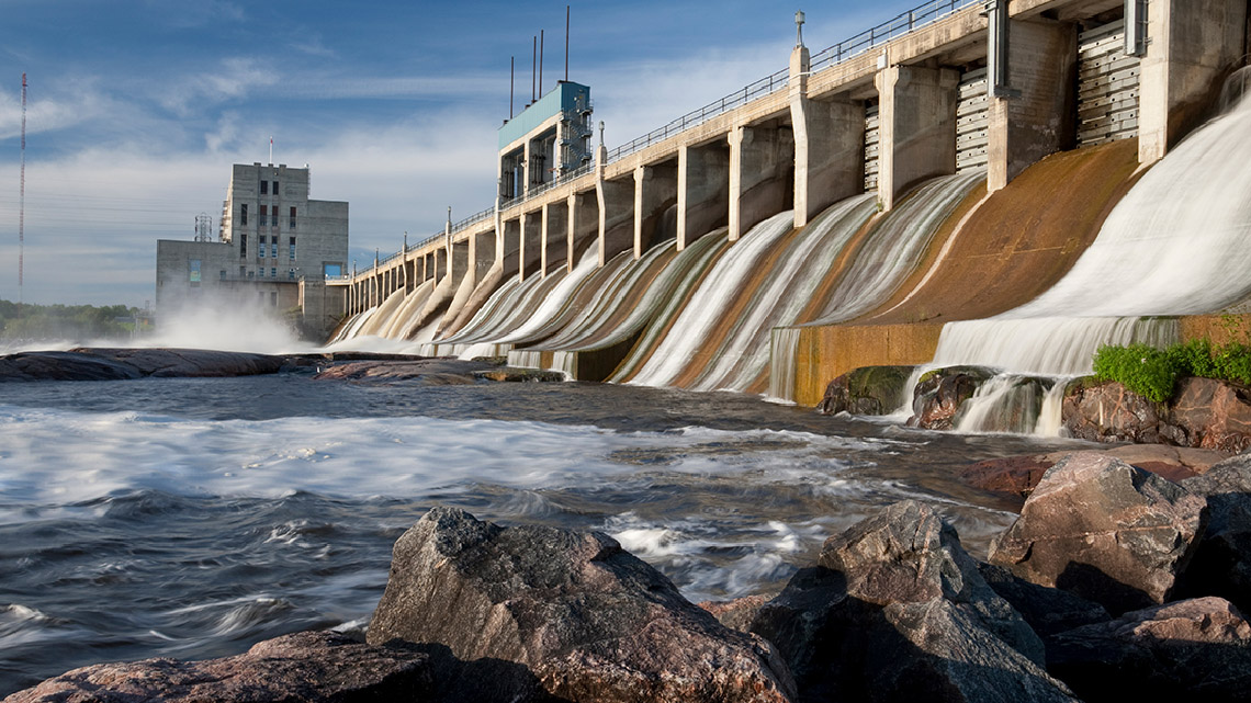
Water is used in every physical region of Canada. This is an image of a hydroelectricity plant in Manitoba.
Displaying natural resources on a map
We are now going to use our Physical Region Characteristics Table to indicate natural resources on a map of Canada. If your table is not complete, you can review the two previous carousels.
Complete the Natural Resources Map activity in your notebook, in the following fillable and printable documents, or in a method of your choice.
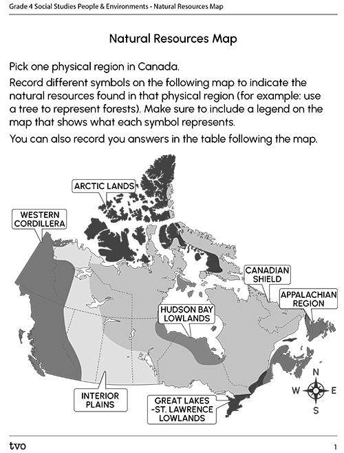
|
Pick one physical region in Canada. Record different symbols on the following map to indicate the natural resources found in that physical region (for example: use a tree to represent forests). Make sure to include a legend on the map that shows what each symbol represents. You can also record your answers in the table following the map. |
|

The Arctic Lands are the most northern physical region in Canada. It covers the northern parts of the Northwest Territories and Nunavut, as well as a small part of northern Yukon. The Western Cordillera is the most western physical region in Canada. It covers most of the Yukon and British Columbia, as well as western parts of the Northwest Territories and Alberta. The Interior Plains are the second most western physical region in Canada. It covers central Northwest Territories, most of Alberta, the southern halves of Saskatchewan and Manitoba, as well as small parts of eastern Yukon and British Columbia, and western Nunavut. The Canadian Shield is the central physical region in Canada. It covers most of Quebec, Labrador, and northern Ontario, the northern halves of Saskatchewan and Manitoba, as well as the southeastern parts of the Northwest Territories and Nunavut. The Hudson Bay Lowlands is a central physical region in Canada that is surrounded by the Canadian Shield. It covers part of northern Ontario, as well as small parts of southern Nunavut, northeastern Manitoba, and western Quebec. The Great Lakes-St. Lawrence Lowlands is the most southern physical region in Canada. It covers southern Ontario, as well as small parts of southern Quebec and western Newfoundland. The Appalachian Region is the most eastern physical region in Canada. It covers New Brunswick, Nova Scotia, Prince Edward Island, most of Newfoundland, as well as a small part of eastern Quebec. |
|
|
Physical region chosen: |
|
|
Natural resources found in that physical region: |
|
Consolidation
Comparing Canada’s physical regions
We are now going to compare and contrast two of Canada’s physical regions.
Choose two of the physical regions that we have explored in this learning activity.
Use your Physical Region Characteristics Table from our Action activity to complete the Comparing Physical Regions Venn Diagram activity in your notebook, in the following fillable and printable documents, or in a method of your choice.
Press the ‘Activity’ button to access Comparing Physical Regions Venn Diagram.
My physical region

Which physical region do you live in?
- What is one characteristic that makes your region unique?
- Which of the physical regions might be challenging to live in? Why?
Record your answers using a method of your choice.
Reflection
As you read through these descriptions, which sentence best describes how you are feeling about your understanding of this learning activity? Press the button that is beside this sentence.
I feel...
Now, record your ideas using a voice recorder, speech-to-text, or writing tool.