Minds On
Exploring society

A society is a group of individuals involved in persistent social interaction, or a large social group sharing the same space or territory.
Brainstorm
Brainstorm
Brainstorm a list of things that you believe a society needs. What rules, rights, and responsibilities should be put in place? What do societies need to be prosperous and functioning?
You can record your list in print, orally, digitally, or in a method of your choice. You may also draw a picture of things that you believe a society needs.
Share your ideas with a peer if possible. What ideas did you both have that were the same? What was different?
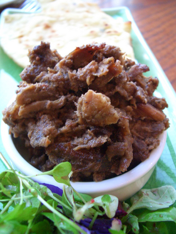
What is pemmican?
As you learn about the colonization of Upper Canada, you will investigate the interactions and relationship between Indigenous communities and colonists.
Press Colonization to review a definition of what the term means.
Colonization is the process in which a foreign power invades and dominates a territory or land base inhabited by Indigenous Peoples by establishing a colony and imposing its own social, cultural, religious, economic, and political systems and values. A colonized region is called a colony.
You will also explore different aspects of the lives of the colonists and of the Indigenous Peoples of the time and how they influenced one another. Let’s begin by exploring pemmican which was, and still is, a large part of Métis life.
Do you know what pemmican is? Explore the following video to deepen your understanding of the importance of pemmican.
Action
Creating Upper Canada
Before you begin, it is important to note that during this time period, Canada was referred to as “British North America.”
The American Revolution was a war fought between 1775 and 1783 through which 13 of Great Britain’s American colonies established the United States independent from British rule. The war had just ended and the Constitutional Act of 1791, also known as the Canada Act, created two colonies – Upper and Lower Canada – that were intimately linked. Upper Canada (west) was up river, closer to the source of the St. Lawrence River, and Lower Canada (east) was down river, closer to the waterway of the St. Lawrence River.
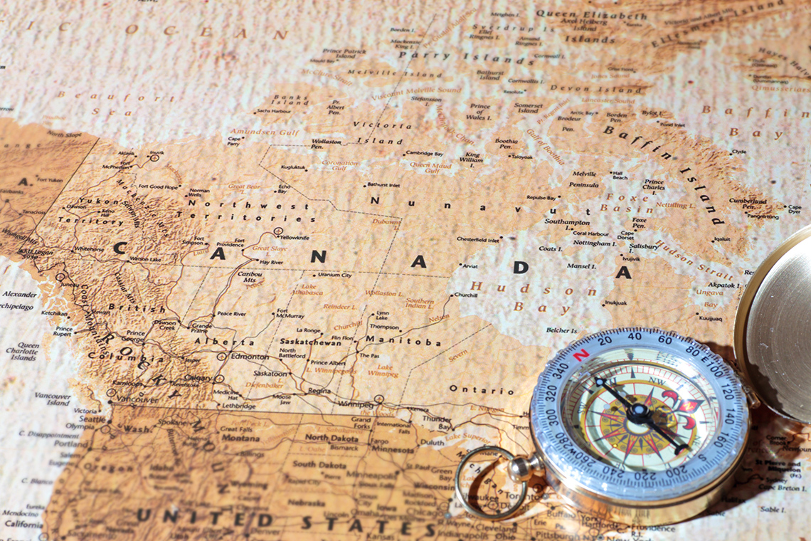
Examine the following map of Upper and Lower Canada. The map shows the divide between the two colonies.

A map showing Upper Canada and Lower Canada. Upper Canada is along the northern coastlines of Lake Superior, Lake Huron, Lake Erie and Lake Ontario. Upper Canada covers the area that is now south-west Ontario. Lower Canada covers the area from the Atlantic Ocean and along the St. Lawrence River. It includes the modern-day areas of Labrador, and southern Quebec.
Brainstorm
Reflect
After examining the map, consider how Upper and Lower Canada were divided into two separate and distinct colonies.
Make a prediction. How do you think settlers and Indigenous communities interacted between Upper and Lower Canada? How might they have remained connected? What do you think their relationship was like?
Press the Hint button to explore a few helpful prompts to get started with these questions.
John Graves Simcoe
The First Lieutenant Governor of Upper Canada was John Graves Simcoe. Simcoe played an important role in colonizing his idea of an “ideal society” in Upper Canada. During this time, many societies already existed in Canada. Upper Canada was populated by many Indigenous communities, particularly the Wendat, Neutral, Tionontatehronnon (Petun), and Algonquins, among many others. These communities were established societies that lived peacefully on the lands of Upper Canada. They had their own rules of governing and for centuries had been meeting the needs of their societies by living respectfully off the land.
Simcoe wanted to create a more “superior, happy, and polished” society that followed his ideals. Therefore, Simcoe aimed to not only attract immigrants, but also renew the empire and set an example to win back Americans into the British camp. He encouraged settlement in Upper Canada by offering free land to anyone who would:
- swear allegiance and loyalty to Britain
- serve Upper Canada in the event of a war
- farm the land
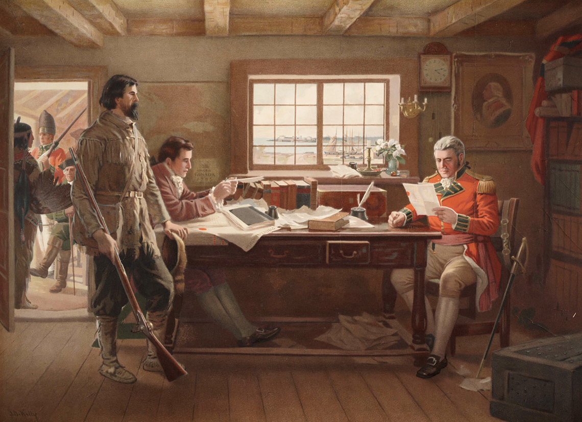
A painting from 1910 showing a late 1700's military official sitting and reading documents next to a bureaucrat, with other military people present.
Simcoe used a series of troops to build roads, which he named “Corduroy roads.” He also established York as the capital of Upper Canada. York became the new capital because Simcoe saw it as a better location for trade and travel due to its proximity to the St. Lawrence River. The location was also further away from the United States in the event a conflict arose. Simcoe was also well known for putting limits on enslavement by introducing the Anti-Slavery Act in 1793. This was to prevent further introduction of enslaved people.
The following map shows where York was located.

A map showing the location of Upper Canada, some of Lower Canada, and Rupert’s Land. Upper Canada is along the northern coastlines of the labelled Great Lakes, including Lake Superior, Lake Huron, Lake Erie and Lake Ontario. Upper Canada covers the area that is now south-west Ontario. The town of York is labelled and is located where modern-day Toronto is located. Lower Canada is along the St. Lawrence River. It includes the modern-day areas of Labrador, and southern Quebec. The town of Montreal is labelled. Rupert’s Land is all of the land north of the two colonies.
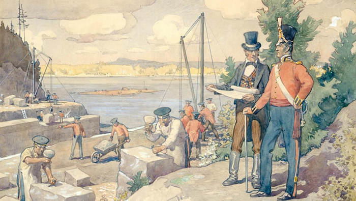
In 1800, Philemon Wright and colonists set up “Chaudière Falls” (modern-day Hull) to expand farmland. Once they settled, they realized timber was more prosperous and they began to export timber to Montreal and Quebec. By 1826, Colonel John By arrived in Bytown on a mission to build a canal (the Rideau Canal) that would connect the Ottawa River to Kingston in case the Americans cut off the St. Lawrence River.
Reading Time
Expand your learning
While building the Rideau Canal, many men lost their lives to disease. To learn more about this, read the article “How Builders of the Rideau Canal Lost Their Lives to Malaria.”
Press tvo today to access "How Builders of the Rideau Canal Lost Their Lives to Malaria."
Opens in a new tabUsing a method of your choice, respond to one of the following questions. If you’d like, you can press the Hint buttons to access additional prompts to help guide your thinking.
1. What events led to the colonization of Upper Canada?
2. How do you think Indigenous communities might respond to colonists on their land?
Métis and settler relations
Pemmican Proclamation
Reflect back to the Minds On activity included in this learning activity. Pemmican is a mixture of dried meat (traditionally bison, moose, caribou, and deer) that is pounded into a coarse powder and mixed with melted fat, and occasionally berries, and eaten as a nutritious food. Pemmican is an important part of Indigenous communities as it could be eaten throughout the year and stored away for winter without spoiling. It was often taken on long hunts as it is easily portable and is high in fat and protein.
In 1814, the governor of Red River Colony, Miles Macdonell established the Pemmican Proclamation, which outlawed exports (mainly pemmican) from the Red River Colony (modern-day Manitoba). This mainly impacted the Métis and fur traders, as this law was meant to save pemmican for Hudson Bay Company (HBC) settlers, which would ruin the North West Company (NWC) and impoverish the Métis.
The Pemmican Proclamation pushed the Métis and NWC to their breaking point, as they felt it was a direct attack against them. It demonstrated rivalries between the two fur trading companies and solidified the racist colonial views of the British towards the Métis. Six months later, MacDonnell issued a further proclamation banning the Métis’ practice of “running the buffalo,” which involved hunting bison on horseback. This also angered the Métis who survived by providing supplies to NWC traders.
These proclamations and attempts to enforce them led to rising tensions and resistance, which eventually erupted in the famous Battle of Seven Oaks.
Source: Canada, L. and A. (2016, May 5). Upper Canada. Library and Archives Canada. https://www.bac-lac.gc.ca/eng/discover/politics-government/canadian-confederation/Pages/upper-canada.aspx.
Reading Time
Primary resource analysis
A primary resource is an original document, raw material, or first-hand account of an event or time period. It represents original thinking and information of a specific time period.
Examine the following Pemmican Proclamation in its original wording. When you have finished, respond to the following questions using the a method of your choice.
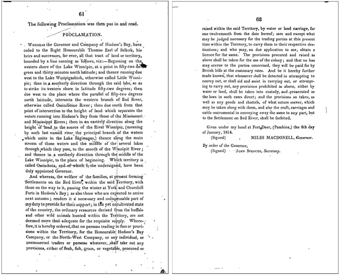
If you would prefer, you can press the Pemmican Proclamation - Text Version button to reveal a text version of the proclamation.
Pemmican Proclamation - Text Version
Pemmican Proclamation
“Whereas the Governor and Company of Hudson’s Bay, have ceded to the Right Honourable Thomas Earl of Selkirk, his heirs and successors, for ever, all that tract of land or territory, bounded by a line running as follows, viz:—Beginning on the western shore of the Lake Winnipic, at a point in fifty-two degrees and thirty minutes north latitude; and thence running due west to the Lake Winipigashish, otherwise called Little Winnipic; then in a southerly direction through the said lake, so as to strike its western shore in latitude fifty-two degrees; then due west to the place where the parallel of fifty-two degrees north latitude, intersects the western branch of Red River, otherwise called Ossiniboine River; then due south from that point of intersection to the height of land which separates the waters running into Hudson’s Bay from those of the Mississouri and Mississippi Rivers; then in an easterly direction along the height of land to the source of the River Winnipic, (meaning by such last named river the principal branch of the waters which unite in the Lake Ságinagas,) thence along the main stream of those waters and the middle of the several lakes through which they pass, to the mouth of the Winnipic River; and thence in a northerly direction through the middle of the Lake Winnipic, to the place of beginning. Which territory is called Ossiniboia, and of which I, the undersigned, have been duly appointed Governor.
And whereas, the welfare of the families, at present forming Settlements on the Red River, within the said Territory, with those on the way to it, passing the winter at York and Churchill Forts in Hudson’s Bay; as also those who are expected to arrive next autumn; renders it a nece-sary and indispensable part of my duty to provide for their support; in the yet uncultivated state of the country, the ordinary resources derived from the buffalo and other wild animals hunted within the Territory, are not deemed more than adequate for the requisite supply. Wherefore, it is hereby ordered, that no persons trading in furs or provisions within the Territory, for the Honourable Hudson’s Bay Company, or the North-West Company, or any individual, or unconnected traders or persons whatever, shall take out any provisions, either of flesh, fish, grain, or vegetable, procured or raised within the Territory, by water or land carriage, for one twelvemonth from the date hereof; save and except what may be judged necessary for the trading parties at this present time within the Territory, to carry them to their respective destinations; and who may, on due application to me, obtain a license for the same. The provisions procured and raised as above shall be taken for the use of the colony; and that no loss may accrue to the parties concerned, they will be paid for by British bills at the customary rates. And be it hereby further made known, that whosoever shall be detected in attempting to convey out, or shall aid and assist in carrying out, or attempting to carry out, any provisions prohibited as above, either by water or land, shall be taken into custody, and prosecuted as the laws in such cases direct; and the provisions so taken, as well as any goods and chattels, of what nature soever, which may be taken along with them, and also the craft, carriages and cattle instrumental in conveying away the same to any part, but to the Settlement on Red River, shall be forfeited.
Given under my hand at Fort Daer, (Pembina,) the 8th day of January, 1814.
MILES MACDONELL, Governor
By order of the Governor,
John Spencer, Secretary.”
Analyze the Pemmican Proclamation by responding to the following questions in a method of your choice. When you are ready, press the Answers button to access some answers for this activity.
- What are the physical characteristics of this document?
This document has the title “Proclamation” and is broken into two paragraphs of text. The document has ink stains on it and appears old. It is numbered pages 61 and 62 of another document.
- Who is the author or creator of this document?
The author is Miles Macdonell, Governor.
- What are three ideas from this document that you think are important? Why?
Answers may vary for this question. Possibilities are:
- They specify the land in question by describing physical characteristics, including lakes, rivers, and latitude/ longitude points.
- They included settlements along the Red River in the document, including people who had not yet arrived but were expected to arrive later on
- It discusses the use of buffalo, “resources derived from the buffalo and other wild animals hunted within the territory are not deemed more than adequate for the requisite supply,” meaning not to use more than needed.
- It outlines limitations on trading
- Items will be taken for the colony and that “no loss may accrue to the parties concerned”
- Anyone who doesn’t follow this proclamation will be taken into custody
- Which view is being represented in this document? Which is missing?
The view that is being represented in this document is the governor's view, or the British. The Indigenous and French perspective is missing from this document. Were they consulted?
- Why do you think it is important to examine primary resources when studying history?
It is important because a primary resource gives you valuable information about original thinking and ideas during that time period
Battle of Seven Oaks
The rivalry between the Métis and British came to a head on June 19, 1816 during the Battle of Seven Oaks, which was part of the Pemmican Wars. Cuthbert Grant, Métis leader and NWC worker, led sixty Métis and First Nations men east, past an HBC blockade, to deliver pemmican to the NWC traders. They were confronted at Seven Oaks by HBC Governor Robert Semple and his men (approximately 28 HBC officers and employees) as they were travelling west. Both groups were expecting trouble, but neither was looking for a gun fight.
As we work towards Truth and Reconciliation, information about lands and territories is constantly being updated. This map was accessed through the permission terms of Canadian Geographic in July 2021.
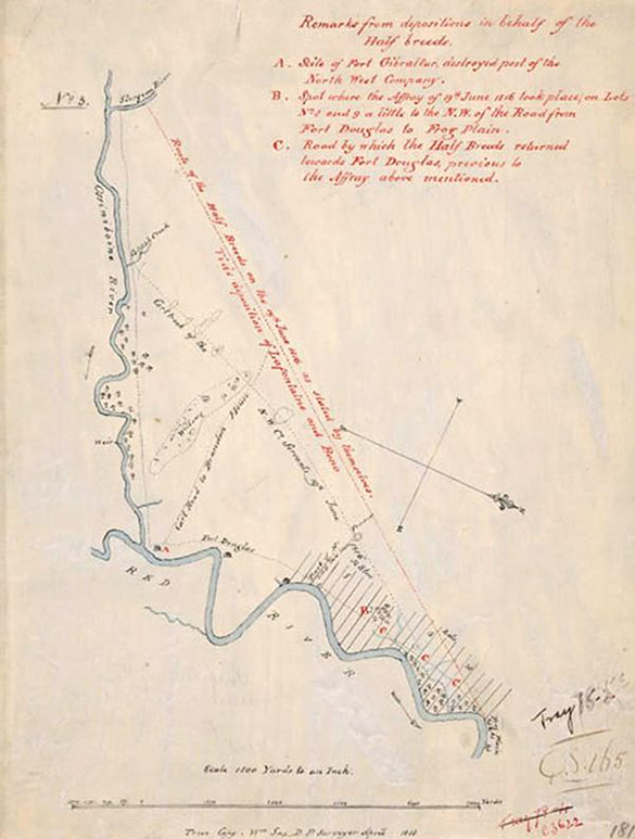
When Semple questioned and challenged the Métis, tempers flared, and a shot was fired at one of Semple’s men. The battle left Semple and 20 of his men dead and one Métis wounded. Grant, the Métis leader, later explained that they were successful in this battle because they threw themselves on their backs while they were loading their guns and Semple’s men thought they were dead. Once reloaded, the men jumped up and took them by surprise.
After the battle, Grant seized Fort Douglas and forced HBC staff to relocate to the Norway house. Grant was charged for his part in the confrontation, but the charges were eventually dismissed.
The Battle of Seven Oaks is historically significant because it was one of the first times the Métis demanded rights and free travel on their lands, asserting themselves as “the New Nation.”
Source: Barkwell , L. (206AD, February 7). Battle of Seven Oaks. The Canadian Encyclopedia. https://www.thecanadianencyclopedia.ca/en/article/seven-oaks-incident.
Source: Belshaw, J. D. (2015, April 13). 8.9 Community and Crisis at Red River. Canadian History PreConfederation. https://opentextbc.ca/preconfederation/chapter/8-9-community-and-crisis-at-red-river/.
Brainstorm
Whose perspective?
Consider the following two paintings. These paintings depict the Battle of Seven Oaks. Whose perspective do you think is represented in these paintings? How do you know?
Record your ideas using a method of your choice.
Press the Hint button to access some help getting started with these questions.
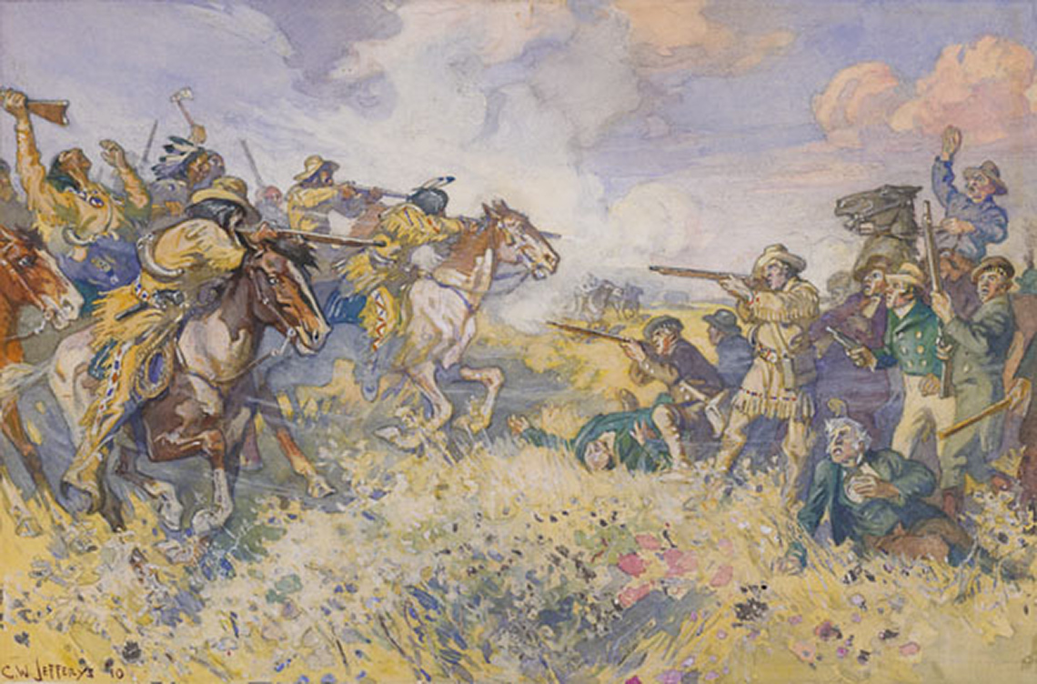
A battle between the Métis and Semple and his HBC men. The Métis are on horseback wearing feathers and war paint, with raised rifles and axes. The horses appear to be moving quickly. In contrast, Semple and his men are mostly on foot and appear frightened and surprised. Some men are wounded and defenseless on the ground. Others have their rifles and pistols raised.
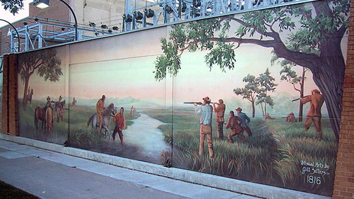
Two groups of men in battle on opposite sides of a ravine. Cuthbert and the Métis are on one side. They are on horseback (the horses are still) or kneeling on the grass with their rifles drawn. On the other side, the HBC men are standing or lying on their stomachs, also aiming their rifles at the opposite side. In the centre of the scene, a man stands ankle deep in the ravine, holding the reigns of a horse carrying a Metis rider.
Investigating biography
Throughout this learning activity, you have briefly learned about significant individuals in Canada during this period. In this section, you will dive deeper and independently investigate one of those individuals and assess the contribution they have on Canadian heritage and/or identity.
You will choose to investigate one of the following individuals:
- Governor Miles Macdonell
- Governor John Graves Simcoe
- Cuthbert Grant
- Colonel John By
- Philemon Wright
Use the following fillable and printable Biography Graphic Organizer to help guide your investigation. If possible, share what you’ve learned with someone when you are finished.
| Person | |
| Date of Birth | Image |
| Background Information (where they grew up, family life, children, jobs, etc.) | |
| Why are they significant? What did they do? | |
| Role / Contribution to Canadian heritage / Identity | |
Press the Activity button to access the Biography Graphic Organizer.
As you complete this activity, use the following success criteria checklist to evaluate your biography.
Success criteria checklist
Consolidation
Creating a timeline
Create a timeline of significant events and people that led up the establishment of Upper Canada. Your timeline should include the following events and people, as well as a one sentence description of how this event or person played a significant role in the formation of Upper Canada.
- Philemon Wright
- Pemmican Proclamation
- John Graves Simcoe
- Establishment of York as capital city
- The Rideau Canal
- Constitutional Act
- “Corduroy roads”
- Battle at Seven Oaks
- Anti-Slavery Act
You can complete your timeline in your notebook, on the computer, or using another method of your choice.
Evaluating impacts
Using specific evidence from your learning, answer the following question using a method of your choice:
How did the events and people from your timeline directly impact the Métis in Canada? How did the Métis respond to these challenges?
Reflection
As you read the following descriptions, select the one that best describes your current understanding of the learning in this activity. Press the corresponding button once you have made your choice.
I feel...
Now, expand on your ideas by recording your thoughts using a voice recorder, speech-to-text, or writing tool.
When you review your notes on this learning activity later, reflect on whether you would select a different description based on your further review of the material in this learning activity.